Newsletter 15
June 2018
Editors view
Dear friends, dear colleagues, dear all,
Summer is in the air (at least in Europe) which means that there are minimally two certainties: the CIPA summer school is about to happen, and there is a new CIPA newsletter. This year, CIPA will land in beautiful Zadar to teach a diverse group of students the very basics of image- and range-based modelling to digitise the surface geometry of cultural heritage assets.
This newsletter also reports on many other related events, both past and forthcoming. Overall, newsletter 15 nicely displays how many members of the CIPA community are spreading the word all over the world by (co)organising workshops or giving keynote lectures.
One of those events was the ISPRS TCII symposium which was held in beautiful Riva del Garda. CIPA expert members Fabio Remondino and Isabella Toschi made it into a wonderfully organised conference with many theoretical and more practically-oriented papers. It was also a delight to see that a significant share of the conference presentations took place in the well-visited cultural heritage sessions.
As always, we remain open to any possible newsletter contribution and welcome every proposal to make our cherished organisation even more visible.
Enjoy reading our new e-newsletter,
Stratos Stylianidis, Geert Verhoeven
Efstratios Stylianidis, Geert Verhoeven
Geert Verhoeven
stratos@geoimaging.com.cy
dam projects and rescue archaeology
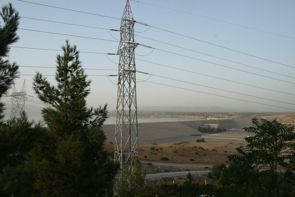
Large-scale dam projects in the Near East have caused significant changes in ecosystems as well as massive undertakings in saving cultural heritage. Incidentally or not all the cultures along Mesopotamia and Egypt in the Near East created and have belonged to the so-called hydraulic civilizations in which irrigation technology needed the organization of societies leading to urbanism and civilization including writing systems. Those civilizations already built dams and tried to change the rivers’ power. It has been said that rivers are mother’s milk for civilizations.
The Birecik dam of the Euphrates in Turkey caused parts of the Hellenistic and Roman city of Zeugma to submerge. Photo: Minna Silver 2016.
One early example of building a dam in modern times is the Assuan dam project that caused the moving of the Abu Simbel temples from the Pharaonic period in Egypt with UNESCO and the help of several countries in the 1960s. The dam project included large-scale international archaeological excavation projects in Nubia as well. The temples had been a tourist attraction for centuries and documented by stereo photographs providing 3D visions already in the 19th century. Actual several ancient monuments and sites were documented along the Nile using stereo photography.
Rescue excavations associated with dam projects have since been taking place in the areas of the Euphrates and the Tigris in Mesopotamia. Syria had the famous Tabqa dam project in the Lake Assad area in the 1970s, the lake also named after the president like the Lake Nasser in Egypt. The international rescue excavations provided evidence of some of the early sedentary societies, domestication of animals and agricultural endeavours. Abu Huryera has brought evidence of cultivation of rye in 9000 BC. Bronze Age kingdoms were revealed in the neighbourhood as well.
Turkey has followed the way of Egypt and Syria. It has the sources of the large rivers of the Euphrates and the Tigris and has undertaken several dam projects to harness water power in recent decades. These have been foreseen as bringing environmental problems, such as desertification in the regions affected by the changes in the flow of the rivers. The construction of the Birecik dam (Fig. 1) on the Euphrates in Turkey in 2000 became the focus of an archaeological salvage project, when an ancient Hellenistic and Roman city of Zeugma with its fabulous mosaics was rescued from massive waters that were taking over the area. In Gaziantep a beautiful museum was built for frescoes and mosaics removed from Zeugma. The finds are resembling Pompeii and Herculaneum in their fine state of preservation.
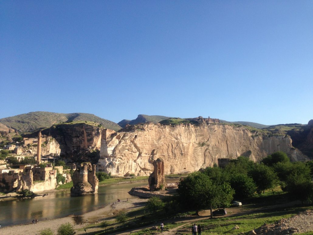
The ancient ruined bridge and citadel of Hasankeyf on the cliffs currently in danger because of a new dam on the Tigris. Photo: Minna Silver 2014.
Other dam sites in Turkey include the Ilisu dam of the Tigris, this year being the opening year of the dam. The dam is associated with the cliff site of the Hasankeyf settlement and citadel in the Batman province in southeastern Turkey (Fig. 2) and is currently in danger when the water levels are rising and cliffs are collapsing. This endangered site has revealed human habitation from ca. 10, 000 BC, currently providing visibility to fabulous Roman, Byzantine and Medieval ruins with a bridge reaching over the river and thousands of human-made caves on the cliffs.
As far as archaeological endeavours are concerned, the sword that archaeologists are facing has two edges: on the one hand the excavations cannot save the sites which will be submerged in their locations, on the other hand, the projects that carry out rescue excavations may provide new scientific information of sites and cultures that otherwise could be left unidentified and undiscovered. Some areas have been archaeologically terrae incognitae, the unknown lands, before they became under archaeological salvage projects.
However, in some cases decisions that can destroy sites by mere ignorance need collective actions of heritage professionals to stop the deterioration or destruction that, for example, Hasankeyf is facing. Already parts of the cliffs have collapsed. The fact that a site needs to be saved in its original location is always the best choice – if we are changing structures to other sites, we are removing the original identity of a place, the memory attached to it and opportunity for future generations to study it with constantly improving archaeological methods. Even if is a step forward, it is a small comfort that the site of Hasankeyf castle has been laser-scanned, because its destruction would be a cultural catastrophe out of measure.
In the worst scenario, a dilemma remains for those professionals that are saving the heritage. We cannot let the human cultural memory to disintegrate completely and leave destroyed places undocumented because of political circumstances with which we do not agree.
Minna Silver
mlonnqvi61@hotmail.com
CIPA participates at the 20th International Course on Stone Conservation (SC17)
March 2018, Mexico
The International Course on Stone Conservation is one of the core training courses implemented by ICCROM (International Centre for the Study of the Preservation and Restoration of Cultural Heritage) that aims to improve the practice of stone conservation for heritage professionals by providing an understanding of decay and deterioration, disseminating effective conservation methodologies, and ensuring a practical knowledge of appropriate repair methods and long-term management strategies. One specific module during the course focused on documentation.
These courses have taken place since 1976 in Italy (Rome and Venice), but the last edition the course took place in Mexico, where it was co-organized by ICCROM and Instituto Nacional de Antropología e Historia (INAH). Originally planned to be held in October 2017, the tragic earthquakes that struck Mexico in September compelled the organizers to postpone until March 2018.
As one of the key building materials in heritage sites all over the world, stone is considered as a fundamental part of conservation studies for professionals specialized in restoration and conservation of architectural and archaeological heritage. In this regard, during the eight-week course, fundamental theories of conservation are discussed, along with advances in technology and research. The course covers both theoretical and practical conservation, with an emphasis on hands-on case studies and site work.
The course includes a specific module on Documentation and Recording for Cultural Heritage. This five-day module introduces the role of information in the conservation process, guiding principles, procedures, tools, and techniques for the appropriate documentation of cultural heritage sites. Information collection can be an extensive and complex process as a critical input to decision making– therefore it is essential to know what information to collect, where to obtain it, why it is needed, and how to achieve pre-established conservation goals. It is also vital to identify information required for protecting values, both tangible and intangible, and for evaluating authenticity and integrity.
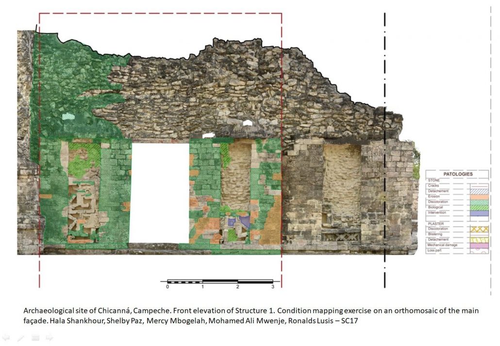
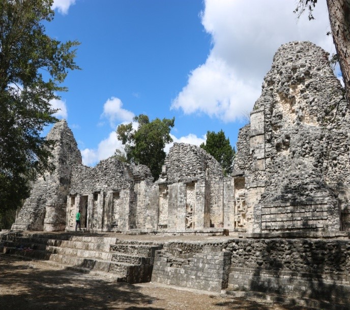
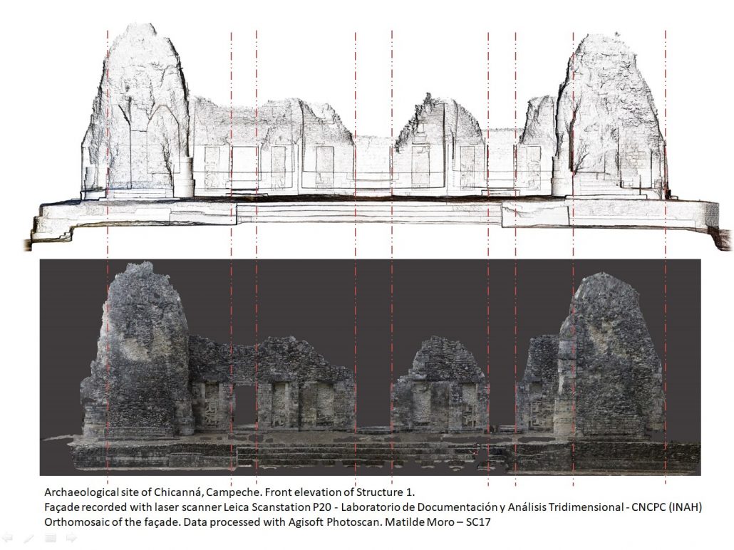
During this module, participants obtained hands-on knowledge through a complete field data acquisition exercise at the Mayan archaeological site of Chicanná, in Campeche Province in the Yucatan Peninsula. The module began with the most common tools: simple manual measurement and photography before moving to more advanced documentation techniques such as photogrammetry, 3D modeling, and environmental monitoring, giving the participants the chance to test a wide range of possibilities and results that various tools can offer. They evaluated the output that different techniques provided during the recording process and assessed and highlighted advantages and disadvantages of each.
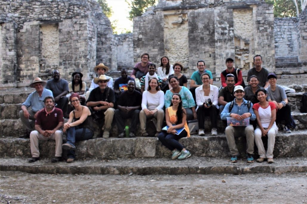
Participants and instructors of the Stone Course at the Mayan site of Chicanná, Campeche – Mexico.
Participants with diverse backgrounds came from 18 different countries creating a multidisciplinary group which included architects, engineers, conservators, managers, scientists, and curators. This wide range of professional backgrounds helped to substantially enrich the exchange of knowledge and skills available in distinctive regions of the world, sharing experiences and different cultural approaches.
Furthermore, the experience provided during the last weeks of the course at the Mayan site in the Calakmul Biosphere Reserve entail specific interactions between environment and cultural heritage that pose further challenges, which reinforce the learning process of the course to address complex conservation issues with a multidisciplinary and integrated approach.
More info can be found here.
Ana Almagro Vidal
ana.almagro@gmail.com
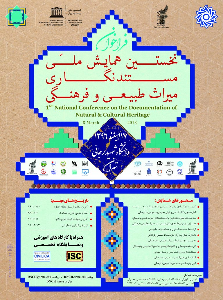
First National Conference on the Documentation of Natural and Cultural Heritage
March 7th-8th, 2018, Tehran (Iran)
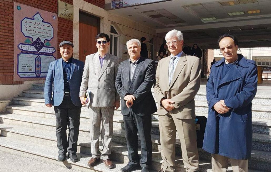
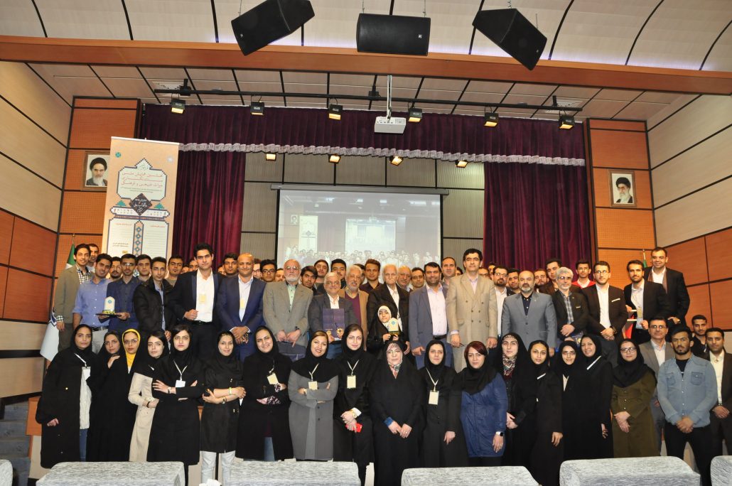
The first National Conference on the Documentation of Natural and Cultural Heritage was held on March 7th and 8th, 2018 at Shahid Rajaee Teacher Training University, Tehran, Iran. It was successfully organized by Dr. Abass Malian, a CIPA Expert member and a team of dedicated Iranian colleagues and final year students. This conference was the first national-level scientific event on the applications of Geomatics, in particular photogrammetry and remote sensing, in the field of environmental monitoring and historical buildings mapping. This event faced an impressive acceptance of experts and scholars all over the country.
The keynote speakers of the opening ceremony and special guests of the conference included:
- Dr. Mohammad Shams Esfandabadi (Deputy of Research and Technology);
- Dr. Abbass Malian (National CIPA Delegate and Conference Director);
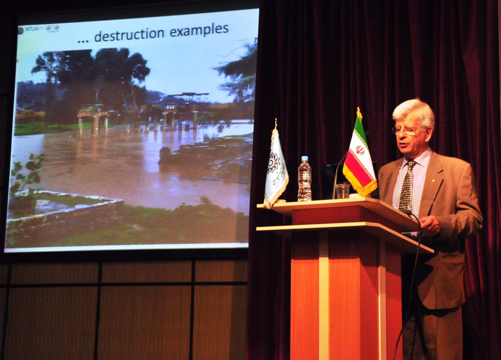
- Prof. Andreas Georgopoulos (President of CIPA the International Scientific Committee on Heritage Documentation);
- Prof. Mohammad Reza Mobasheri (Professor in Remote Sensing at K.N. Toosi University);
- Prof. Seyyed Kazem Alavi Panah (Professor in Remote Sensing at Tehran University);
- Dr. General Mehdi Modiri (Head of the Geographic Organization of the Armed Forces);
- Dr. Mohammad Hassan Talebian (Deputy Director of the Iranian Cultural Heritage Organization);
- Dr. Mohammad Saadat Seresht (Tehran University);
- Dr. Hamid Ebadi (K.N. Toosi University);
- Dr. Saeid Sadeghian (National Cartographic Center);
- Dr. Mohammad Reza Malek (K.N. Toosi University);
- Dr. Behzad Saeedi Razavi (Iranian Institute of Standard);
- Eng. Ali Sadeghi Naeini (Director of the Remote Sensing Section in the Iranian Space Agency);
- Eng. Mahmoud Ghaffarian (Astan Quds Razavi).
In addition to the conference, a special exhibition was arranged with organizations and companies associated with the topic of active attendance and was welcomed by many visitors and conference participants.
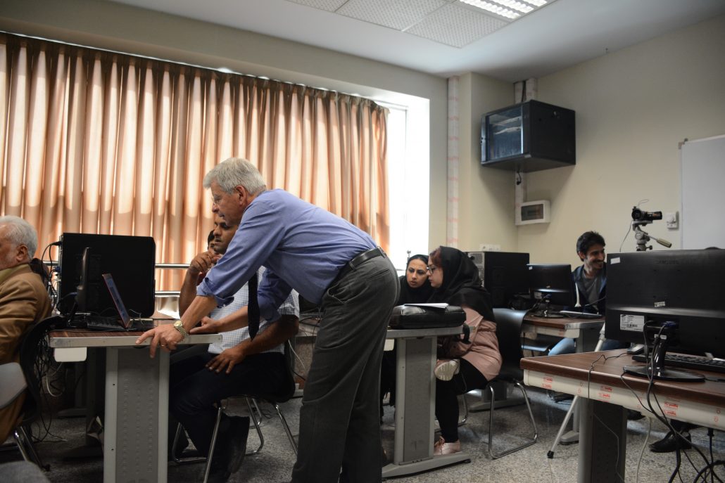
Prior to the Conference a series of Workshops were staged on March 7th, 2018. CIPA contributed with an “Image Based Modelling” half day theoretical and practical tutorial.
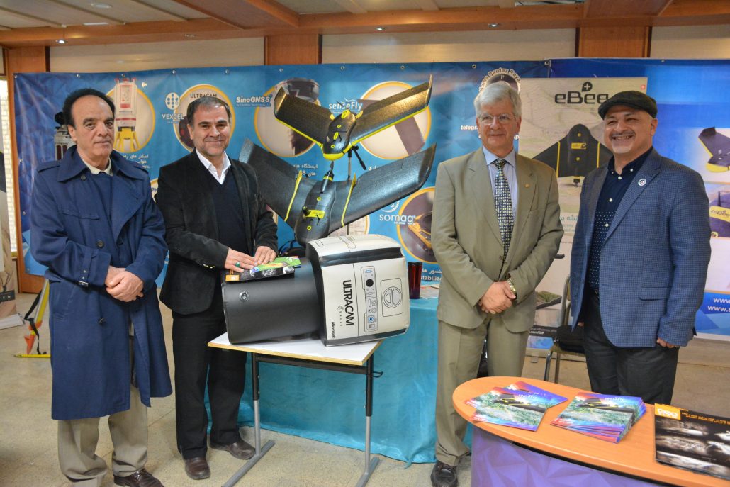
The eight specialized technical workshops were presented on the sidelines of the conference, which were held with the participation of many enthusiasts. The workshops, some of which were held for the first time in the country, included:
- Spectrometry (Lab, Field, Space) for Heritage Documentation;
- Image-Based 3D Modeling by CIPA-Heritage documentation;
- Applications of Virtual and Augmented Reality in Building Documentation;
- Principles of 3D Optical Scanners for Heritage Documentation;
- Principles of Documentation of Civil Engineering Projects;
- Applications of UAVs in Heritage Documentation;
- Practical Demonstration of GeoSLAM ZEB Revo Technology for Heritage Documentation;
- Practical Demonstration of SenseFly Technology for Heritage Documentation
More than thirty universities, organizations, and reputable companies had scientific and spiritual support. Special sponsors and supporters of the conference were:
- International Committee on Heritage Documentation (CIPA);
- National Geographic Organization of the Armed Forces (NGO);
- Tehran Construction Engineering Organization (TCEO).
Despite the specialized nature of the conference, more than 100 scientific articles were received in the secretariat of the conference. After reviewing by at least three specialists, 90 papers were accepted for oral or poster presentation at the conference. Due to the precise planning, the rich scientific content of the programs and the high quality of the articles presented, this event was appreciated by both domestic and foreign participants and is expected to become a milestone in the scientific and professional community in this specialized field in Iran.
Abass Malian and Andreas Georgopoulos
abbass.malian@gmail.com and president@www.cipaheritagedocumentation.org
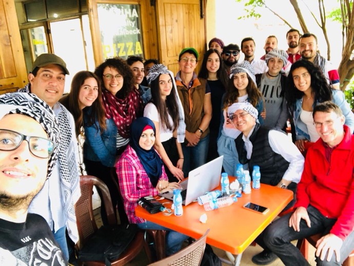
Documentation exercise on Bacchus temple in Baalbeck
April 28-29th, 2018, Baalbeck (Lebanon)
The centre of restoration and conservation (crc) of historical monuments and sites is a specialized Academic Centre attached to the Faculty of Fine Arts and Architecture of Section III of the Lebanese University. Founded in 1997, the CRC provides professional training for architects and civil engineers graduates, after whom a master’s degree in conservation and restoration of historic sites and monuments is issued to architects since 1997, while a master’s degree in conservation and strengthening of historical structures is issued to engineers since 2009.
The group of architects and engineers with their tutors in Baalbeck.
This teaching is delivered over two academic years part-time to facilitate the availability of professionals. Common courses are offered during the first semester, and the second year is devoted largely to a professional project. A research note on a topic related to the practice of heritage, each in its professional setting and a work placement complete this teaching of 120 credits. To date, CRC has hosted nine professional promotions. These architects and heritage engineers deliver their expertise in various sectors, including academic teaching, project consulting, project management, public administration, conservation and restoration companies and research on the architectural and archaeological heritage. The founding director of CRC is Dr Rawya Majzoub-Barakeh; today Dr Yasmine Makaroun Bou Assaf is heading CRC.
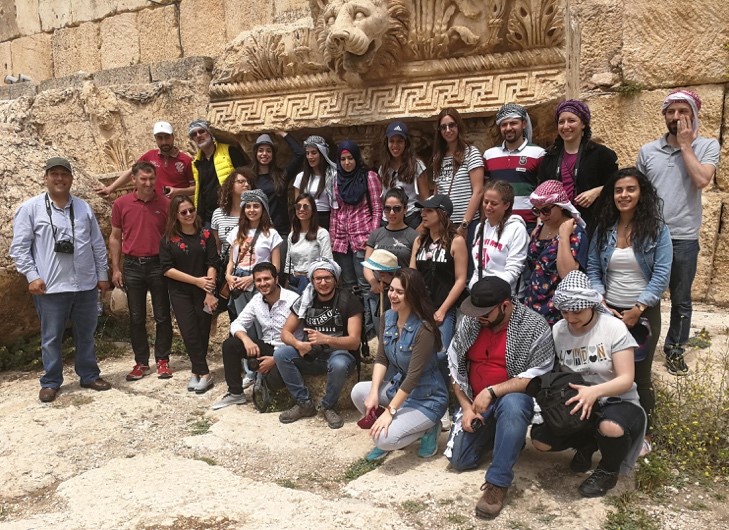
The purpose of the exercise was to train architects and engineers getting their master’s degree at CRC on methodologies to apply for the 3D documentation of historical monuments. In coordination with the Ministry of Culture – Directorate General of Antiquities in Lebanon, the World Heritage Site of Baalbek was the place where the exercise took place, more precisely in the internal walls of Bacchus temple. The documentation processed within that exercise was to be delivered to the Antiquities administration. The applied methodology in the exercise case was photogrammetry.
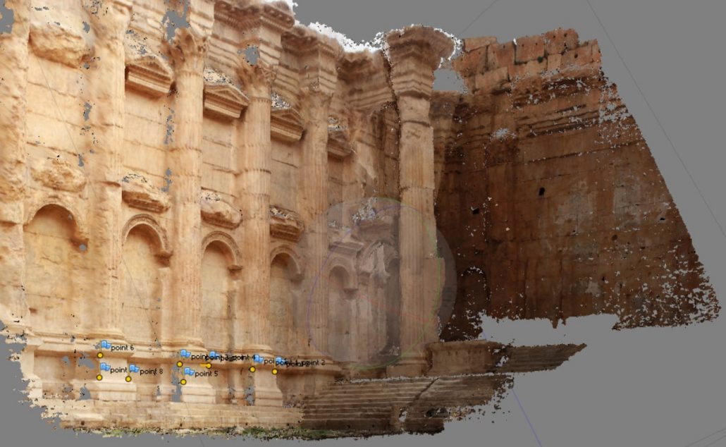
Examples of point clouds from the Bacchus Temple in Baalbeck processed by the students from their own photographs.
The workshop was performed on April 28-29th by 25 students under the supervision of Dr. Pierre Grussenmeyer, Dr. Yasmine Makaroun Bou Assaf and Dr. Jean Yasmine. The students had to organize the recording after a one day lecture dedicated to recording, imaging, and applying the rules of photogrammetric capture and relevant processing. Agisoft Photoscan © was utilized in the framework of this tutorial. The participation of Pierre Grussenmeyer was supported by the French Ministry of Foreign Affairs.
For more information about the CRC in Lebanon, please use this e-mail address.
Pierre Grussenmeyer
pierre.grussenmeyer@insa-strasbourg.fr
8th 3D-ARCH workshop
The 8th ISPRS/CIPA 3D-ARCH international workshop on “3D Virtual Reconstruction and Visualization of Complex Architectures” will be held in Bergamo (Italy) on 6-8 February 2019. Bergamo is a heritage city which will offer many sightseeing opportunities to participants.
The event is the 8th in a row after the successful editions in 2005 in Venice (Italy), 2007 in Zurich (Switzerland), 2009, 2011, 2013 in Trento (Italy), 2015 in Avila (Spain) and 2017 in Nafplio (Greece). The 2019 edition will focus on the steps and processes for smart 3D reconstruction, modelling, accessing and understanding of virtual environments from multiple data sources. Topics include:
- multi-source data and multi-sensor approaches;
- low-cost sensors and open-source algorithms for terrestrial 3D modeling;
- automation in data registration
- image matching and 3D reconstruction;
- point cloud analysis;
- 4D modelling;
- procedural modeling and BIM;
- accuracy requirement and assessment in 3D reconstructions;
- virtual and Augmented Reality applied to the visualization and conservation of complex architectures and heritage;
- the event will have single-track technical sessions with oral presentations, poster sessions and demos;
- invited speakers, long discussions and enjoyable social events will make the event another rememberable in the long series of the workshop;
- the abstract submission (at least 1000 words, possibly with figures) is due to October 29th, 2018 whereas the final paper (ISPRS format, max 8 pages) is due to December 21st, 2018.
The event will have single-track technical sessions with oral presentations, poster sessions and demos. Invited speakers, long discussions and enjoyable social events will make the event another rememberable in the long series of the workshop. The abstract submission (at least 1000 words, possibly with figures) is due to October 29th, 2018 whereas the final paper (ISPRS format, max 8 pages) is due to December 21st, 2018.
More info can be found here.
Fabio Remondino
remondino@fbk.eu
3dom.fbk.eu
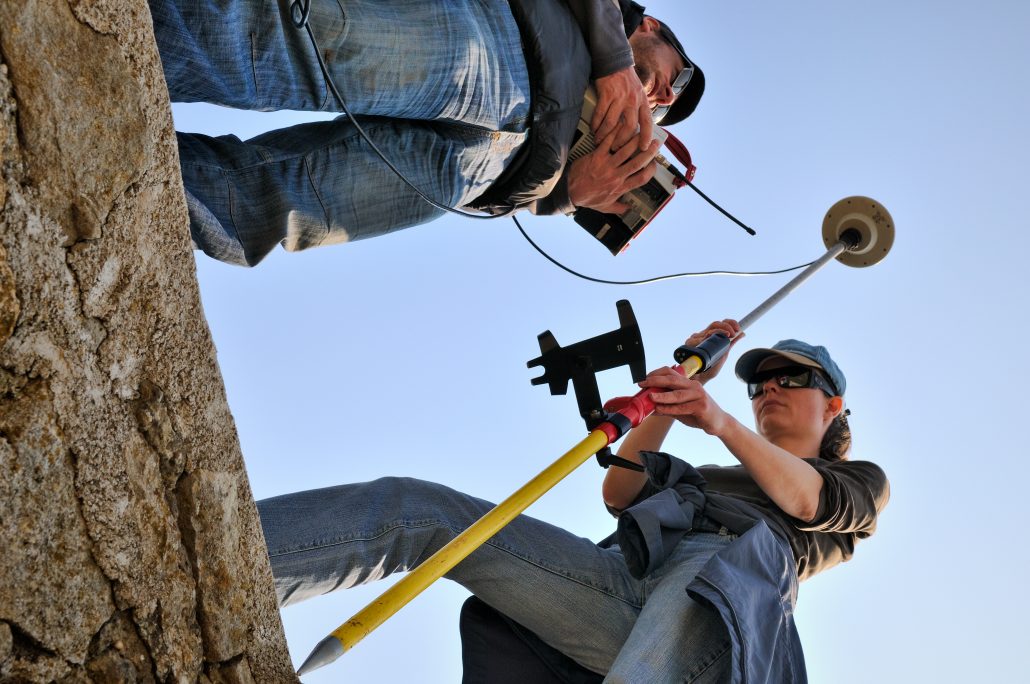
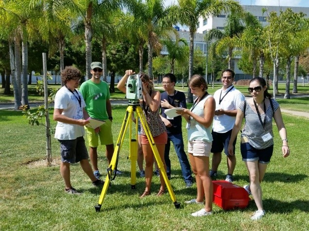
CIPA summer school 2018
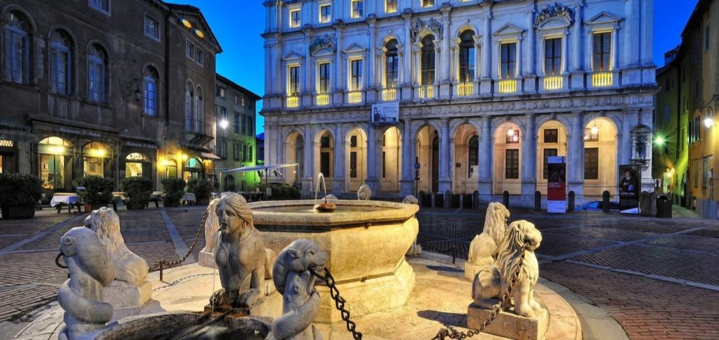
The 5th International CIPA Summer School will be held in the beautiful location of Zadar, Croatia from 15-21 July 2018.
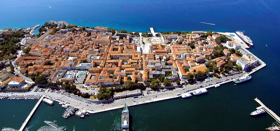
The school will have 26 participants from 10 different countries. The event will be supported by all CIPA Sustaining Members and will give the opportunity to scholars, PhD students, researchers and specialists in the surveying, architecture, and heritage conservation fields to refresh and deepen their knowledge and expertise with reality-based 3D modelling techniques.
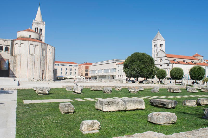
Theoretical lectures will be followed with field acquisitions (photogrammetry and laser scanning) in the archaeological area and museum of the city. The participants, during the practical works, will be divided in groups and, with the help of 12 tutors, they will exercise with photogrammetry, 3D scanning and total station survey. Each group will present the achieved results during the last day of the school.
Isabella Toschi
toschi@fbk.eu
3dom.fbk.eu
Call for Papers: Virtual Archaeology Review
Special Issue: Computer models and virtual reconstructions of Neolithic scenarios
The journal Virtual Archaeology Review (VAR) is launching a Special Issue on ‘Computer models and virtual reconstructions of Neolithic scenarios’ that will be published in January 2019.
The Neolithic is one of the most important periods in human history. It is defined as the moment when humans changed foraging, hunting and gathering as survival strategy for farming, husbandry and the production of resources. New behaviours, new technologies, new cultures and social organisation emerged. The archaeological study of these periods of change is difficult because it is necessary to make emphasis on agency and social dynamics. Computer simulation is therefore the most appropriated way to explain available archaeological data and “see” in the computer what cannot be preserved.
This Special Issue of VAR is dedicated to computer models and virtual reconstructions of Neolithic scenarios. We are looking for papers applying all kind of visualisation technology to the reconstruction of objects, houses and landscapes from any archaeological site in the world where the transition to farming is attested. We are especially interested in how shape analysis can be used to reconstruct and functionally analyse early pottery or stone tools. The possibilities of virtual reconstruction of timber objects can also be explored. Another subject of interest is built space and the architectonics of prehistoric huts and other built structures. Reconstructions of prehistoric landscapes at the time of the origins of agriculture are also welcomed.
© V. Moitinho de Almeida
In any case, well beyond usual scene visualisations, we would like to make emphasis on agency and social action, and not only on objects and buildings. Reconstructing funerary practices and/or astronomic observations can also be of interest. The usage of video game approaches for explaining history to wider audiences is also an interesting approach that can find its place in this special issue.
Deadline for manuscript submission: 15 July 2018. For more info, check the VAR website.
Looking forward to receiving your article. Best regards,
Prof. Juan A. Barceló, Associate Editor
Prof. José Luis Lerma, Editor-in-Chief
Juan A. Barceló and José Luis Lerma
jllerma@cgf.upv.es
polipapers.upv.es/index.php/var
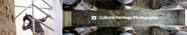
Cultural Heritage Photography
The preservation of cultural heritage is the focus of countless NGOs and research institutions the world over. But what is cultural heritage and what are the issues and challenges of documenting it? Learn how to document “tangible cultural heritage” – the buildings and structures that are unique to a location, as well as “intangible cultural heritage” – the dances, music, and art of a people. Craft a story while you’re here guided by a gifted photographer who has worked for over a decade with NGO and research institutions in Egypt, Turkmenistan, Oman and Canada documenting cultural patrimony.
Where: Maine Media, Rockport Maine
Date: Sept 16 – 22, 2018
More info can be found here.
Owen Murray
omurray@ommphoto.ca
ommphoto.ca
Agisoft PhotoScan projects
Agisoft LLC (www.agisoft.com) is an innovative research company with a focus on professional photogrammetric software development. Agisoft PhotoScan, being run on a single desktop computer (Windows, Linux, Mac OS) or on a cluster for massive data management, enables the user to process digital images into the accurate spatial data, like Dense Point Clouds, Textured Polygonal Models, Georeferenced True Orthomosaics and DEMs.
Agisoft PhotoScan software presents diverse and advanced functionality making the tool popular among the professionals in various fields. An international team of underwater archaeology surveyors from the Universities of Nottingham, Ain Shams and Alexandria, for example, have collaborated through 2017 to digitally record S.S. Thistlegorm shipwreck, laying under 32 m of water in the Red Sea. The resulting accurate 3D models cover 28689 sq.m. of both the external and internal areas of the site featuring every detail. Over 600 historical sites have been documented around South America, including the world-known Machu Picchu city, by Peru’s drone archeology team, who has chosen PhotoScan software for the imagery processing. Taiwan’s National Cheng Kung University applied photogrammetry for the project of a different nature – inspection of the damage caused by an earthquake in Taiwan, February 2016.
Furthermore, urban management tasks are effectively solved with 3D models reconstructed for the entire cities, like the one generated for the city of Tomsk, Russia (320 km², 2014). Among the recent agricultural user cases, the project held in Central Russia can be named as an example of vegetation index calculation large-scale tasks (1000 ha, 2015).
While all the kinds of applications mentioned above are accuracy-focused, PhotoScan is also employed in the fields where texture quality matters, namely, game design and visual effects industries. Detailed 3D models of natural and artificial assets generated in PhotoScan are widely used for environmental design (such as Redwood forest by MAWI United). Popular computer games (Star Wars Battlefront by EA Dice, The Vanishing of Ethan Carter by The Astronauts, The Talos Principle by Croteam) and films (Mad Max: Fury Road by Iloura, Edge of Tomorrow by Sony Pictures Imageworks, Lincoln by Framestore), have proven that PhotoScan photogrammetric software becomes an indispensable part of a designer’s work.
The Agisoft team constantly works on improvements for PhotoScan software to be an efficient solution for the tasks our users face.
Diana Ovod
diana.ovod@agisoft.com
www.agisoft.com
Arches Version 4 Demo Available
The Getty Conservation Institute is pleased to announce that an Arches v4 demonstration site is now available online. The site gives users the opportunity to get a hands-on perspective of the ArchesTM v4 platform, including adding and editing data through the Resource Manager and managing vocabularies through the Reference Data Manager, without having to install the software.
Access the ArchesTM v4 demonstration site here.
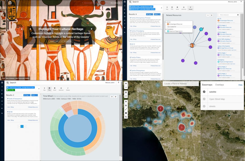
Arches v4 has several new features and enhancements compared to v3 that are accessible in this demo site, including:
- Integrated map and search pages – Arches v4 combines the map and search interfaces in order to create a more robust data exploration experience;
- Time wheel – The time wheel visualizes all the date values in the system to provide a searchable graphical distribution of time data;
- Fuzzy dates – Using the Library of Congress’ Extended Date Time Format, Arches v4 has the capability to incorporate fuzzy dates into date search;
- Advanced Search – In addition to the single box search, Arches v4 incorporates the ability to build an advanced search using any combination of data fields in the system;
- Enhanced Related Resources display – Alongside the graphical network representation of related resources, Arches v4 also includes a searchable panel of related resources to help navigate relationships.
Also, learn about the new implementation of ArchesTM v4 by the City of Lincoln, England, known as ARCADE, launched on May 17, 2018. Read more about ARCADE, Lincoln’s new historic environment record, as well as watch a short video about what it means for the City of Lincoln’s heritage management efforts and the citizens of Lincoln.
Learn more about Arches here.
David Myers
dmyers@getty.edu
archesproject.org
RIEGL Waveform-LiDAR Sensors and Systems
Data Acquisition in Archaeology and Cultural Heritage Documentation
Celebrating 40 years in 2018, RIEGL Laser Measurement Systems is an international leading provider of cutting edge technology in airborne, mobile, terrestrial, industrial and unmanned laser scanning solutions for multiple fields of application, including archaeology and cultural heritage documentation.
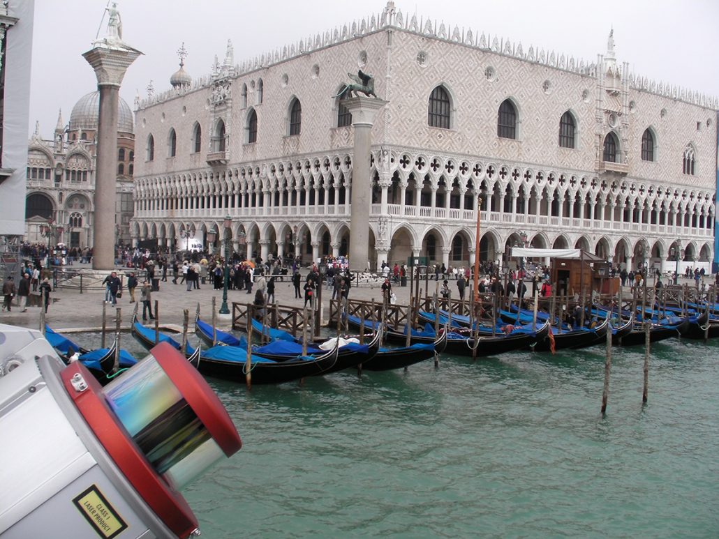
RIEGL mobile mapping systems can be mounted on various moving platforms, such as boats, trains, road and off-road vehicles, and enable the acquisition of highly accurate, dense, and feature-rich data while in motion. The RIEGL VMX-250 was used to scan the palaces at Canal Grande in Venice, Italy.
RIEGL has demonstrated a long-standing commitment to the digital preservation of cultural heritage sites. Its digital preservation support of sites such as the Pyramids in Giza, the Sphinx, the Domitilla Catacombs in Rome, Frauenkirche in Dresden, St. Stephen’s Cathedral in Vienna and numerous other significant monuments is providing future generations with the ability to visit such sites in digital form.
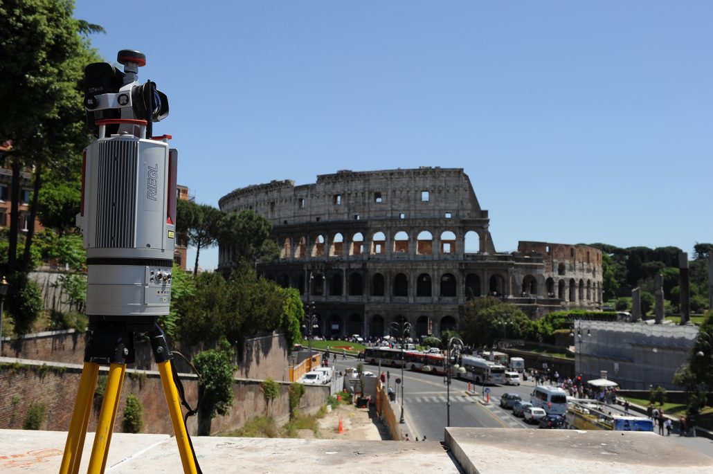
Terrestrial Laser Scanners provide highly accurate 3D data from the whole scene. Scan data is combined with camera data to create highly informative point clouds. Here, the RIEGL VZ-400i was used to scan Rome’s famous Flavian Amphitheatre Colosseum.
The company maintains an outstanding history of reliability and support to their customers. From initial purchase, to integration of the systems, as well as training and support, RIEGL stands out as an industry leader. Worldwide sales, training, support and services are delivered from RIEGL’s Austrian headquarters and its offices in Vienna, Salzburg, and Styria, main offices in the USA, Japan, and in China, and by a worldwide network of representatives covering Europe, North and South America, Asia, Australia and Africa.
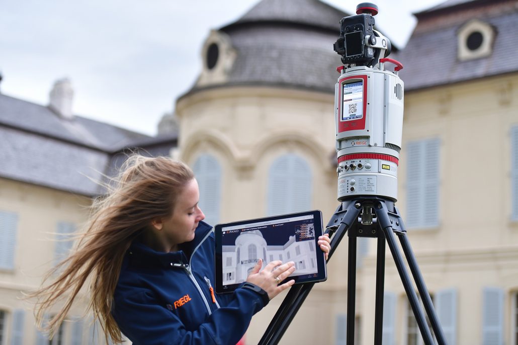
The new RIEGL VZ-400i Terrestrial Laser Scanner sets a new standard in user-friendliness –the scanner is easy to operate, customizable workflows provide high field efficiency and automatic registration enables tremendous time savings. Here, the RIEGL VZ-400i was used to scan the whole complex of castle Niederweiden in Lower Austria.
RIEGL has been producing LiDAR systems commercially since 1978 and focuses on pulsed time-of-flight laser radar technology in multiple wavelengths.
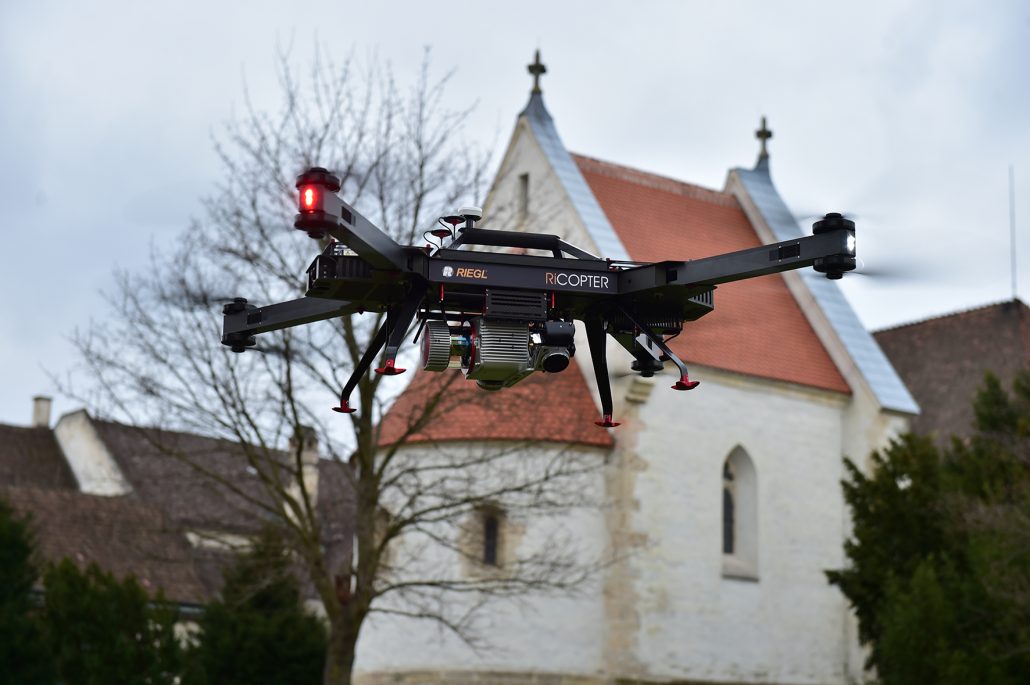
Unmanned laser scanning offers an excellent cost-to-benefit-ratio for numerous applications, e.g. cultural heritage documentation. Here, Goettweig Abbey has been surveyed using the RiCOPTER, RIEGL’s remotely piloted octocopter equipped with the RIEGL VUX-SYS airborne laser scanning system.
RIEGL’s core “smart waveform” technologies provide pure digital LiDAR signal processing, unique methodologies for resolving range ambiguities, multiple targets per laser shots, optimum distribution of measurements, calibrated amplitudes and reflectance estimates, as well as the seamless integration and calibration of systems. RIEGL’s various 3D scanners offer a wide array of performance characteristics and serve as a platform for continuing “Innovation in 3D®” for the laser scanning industry.
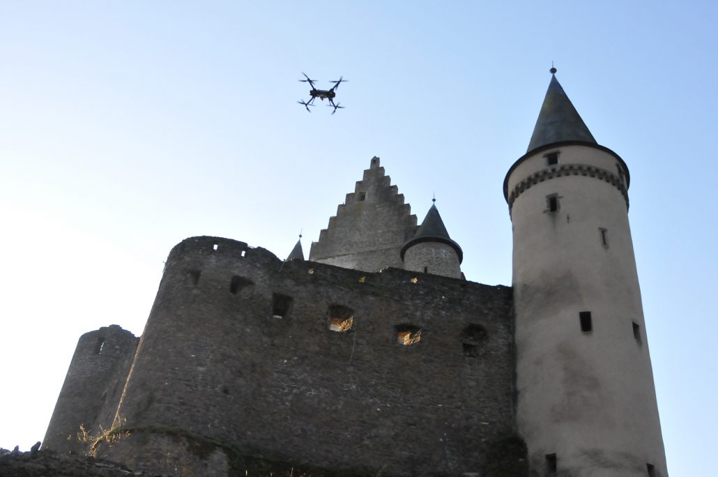
Using the RiCOPTER for a 3D laser scanning documentation of Vianden Castle, Arctron 3D GmbH clearly demonstrated that it is able to conduct very complex 3D inventories in an extremely short amount of time
For more information, visit the RIEGL website.
Silvia Zaiser
szaiser@riegl.co.at
www.riegl.com

