Newsletter 14
February 2018
Editors view
Dear friends, dear colleagues, dear all,
The next big event for CIPA Heritage Documentation is the ISPRS Technical Commission II 2018 Symposium, titled “Towards Photogrammetry 2020”. This scientific gathering will take place in Riva del Garda (Italy) from the 3rd to the 7th of June 2018. During the symposium, CIPA will not only organise a special session, but also its regular Executive Board meeting.
About one month later, the fifth edition of our successful summer school will open its doors. From 15-21 July 2018, the city of Zadar (Croatia) will host a group of enthusiastic students that want to delve into the world of cultural heritage 3D surface documentation. Similar to the four previous editions, this summer school will consist of theoretical lectures (on photography, photogrammetry/computer vision, laser scanning and total station survey) and practical work, in the field and in the lab. Our webpage will provide more information regarding this event in the coming days. Stay tuned!
Finally, we want to say once more that our newsletter is available for the whole heritage community. We aspire to promote the work of young and established researchers as well as commercial teams working in this field. If you would like to publish news of interest, promote hard- and software, bring specific literate to our attention or disseminate project information, just contact us and send your contribution. We do count on your support!
Enjoy reading our new e-newsletter,
Stratos Stylianidis, Geert Verhoeven
Efstratios Stylianidis, Geert Verhoeven
Geert Verhoeven
stratos@geoimaging.com.cy
Cycloramas presenting sites and monuments from the past
Before cinemas panoramas or 360 ͦ views provided popular entertainment in the 19th century. First experiments were already made in the late 18th century. The spectator could immerse into the middle of a panorama and participate in a narrative world through large pictures produced by various methods. Depending on the way by which the presentations were collected and composed they could be daguerreotype-based dioramas, modeled panoramas or cycloramas.
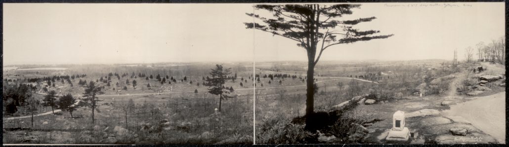
A panorama over the Gettysburg battle ground published in 1909. Library of Congress
The presentations were installed in town halls, museums or special buildings. Paintings, drawings, shade images or photographs were presented on circular walls, and some three-dimensional objects could have been added providing particular visual effects. In cycloramas the panoramas were circular and could be moving. History was awakened in front of the viewer. Battle scenes of various kinds were presented. One could immerse into the events of the Trojan war. The battle of Gettysburg from the American civil war was especially produced as an effective cyclorama.
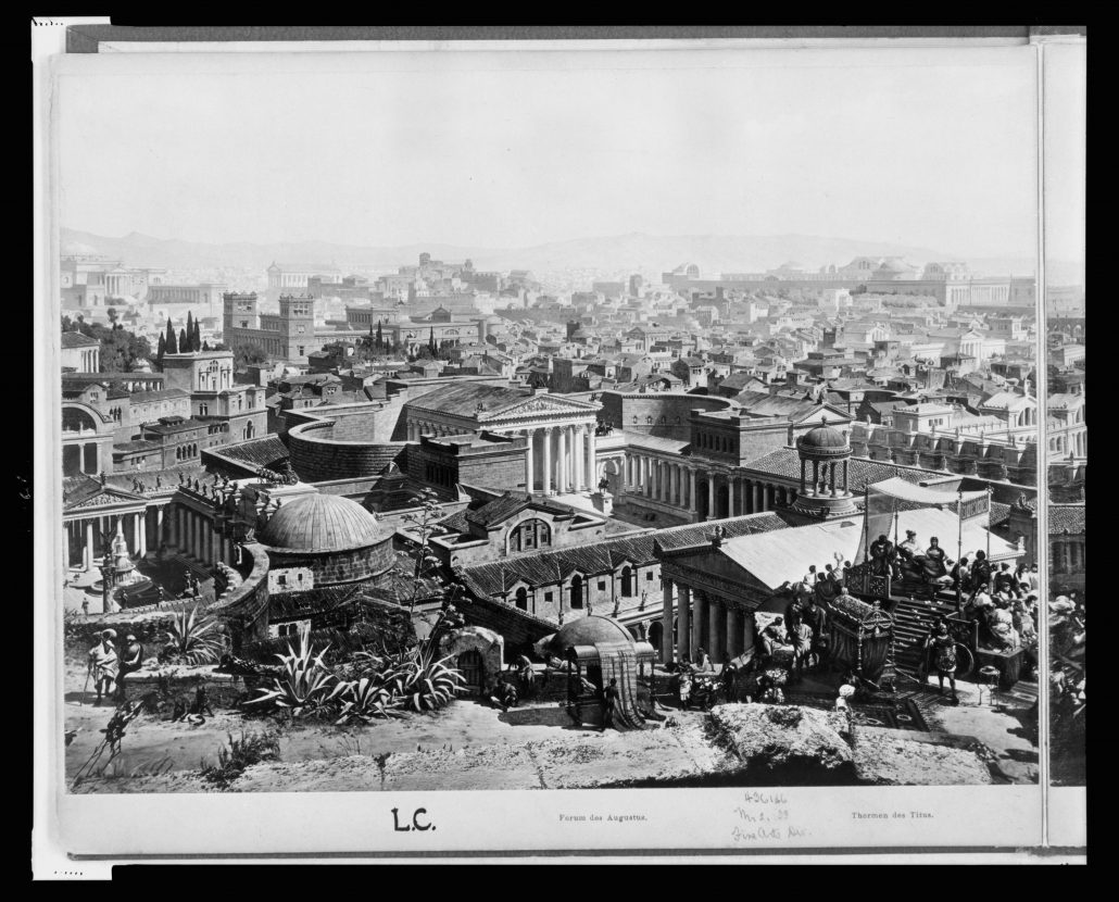
Panoramic view over Rome during Constantine the Great after Büllman and Wagner 1892. Library of Congress
One could visit as tourist places in distant areas and have a Voyage around the World. Panoramic views of ancient Thebes, Nineveh, Jerusalem, Athens, Rome, Pompeii, Baalbek and Constantinople were displayed. Excavations could be illustrated, and detailed explanations of the ruins provided on canvases. Archaeological visits to Pompeii could also be replaced with a cyclorama. Vesuvius erupting in AD 79 could be vividly illustrated, and the life in this Roman city buried in pumice and lava. Last Day of Pompeii was presented in various parts of the world. Nearly contemporary Jerusalem in the time of Christ was experienced as well.
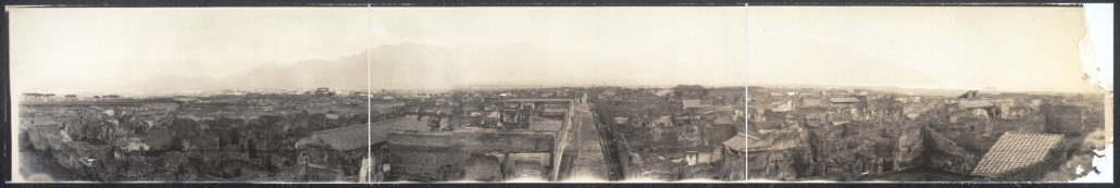
The panorama of the Destroyed city of Pompeii from 1909. Library of Congress, Muffet Studios
Minna Silver
mlonnqvi61@hotmail.com
Documentation of the hypostyle hall of the great temple of Amon-Re in Karnak Egypt – A pharaonic project
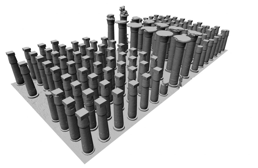
For the thousands of daily visitors who discover the great dynastic temple of Amon-Re in Karnak, the hypostyle hall is undoubtedly the most spectacular part of the monument. This immense room of more than 5000m², built at the time of Seti I in the 13th century BC, is the support of a very dense epigraphy, whose colors are often saved. The ceiling is supported by 12 central columns with a diameter of 3m rising to 20 meters and 122 side columns 13 meters high and a diameter of 2m50.
However, as famous as it is, the great hall remains poorly documented: until recently, there was no exhaustive photographic survey of the decor, necessary for a detailed analysis. Part of this gap was filled in the last century by a major photographic survey campaign. However, to complete this documentation, it remained to treat the columns.
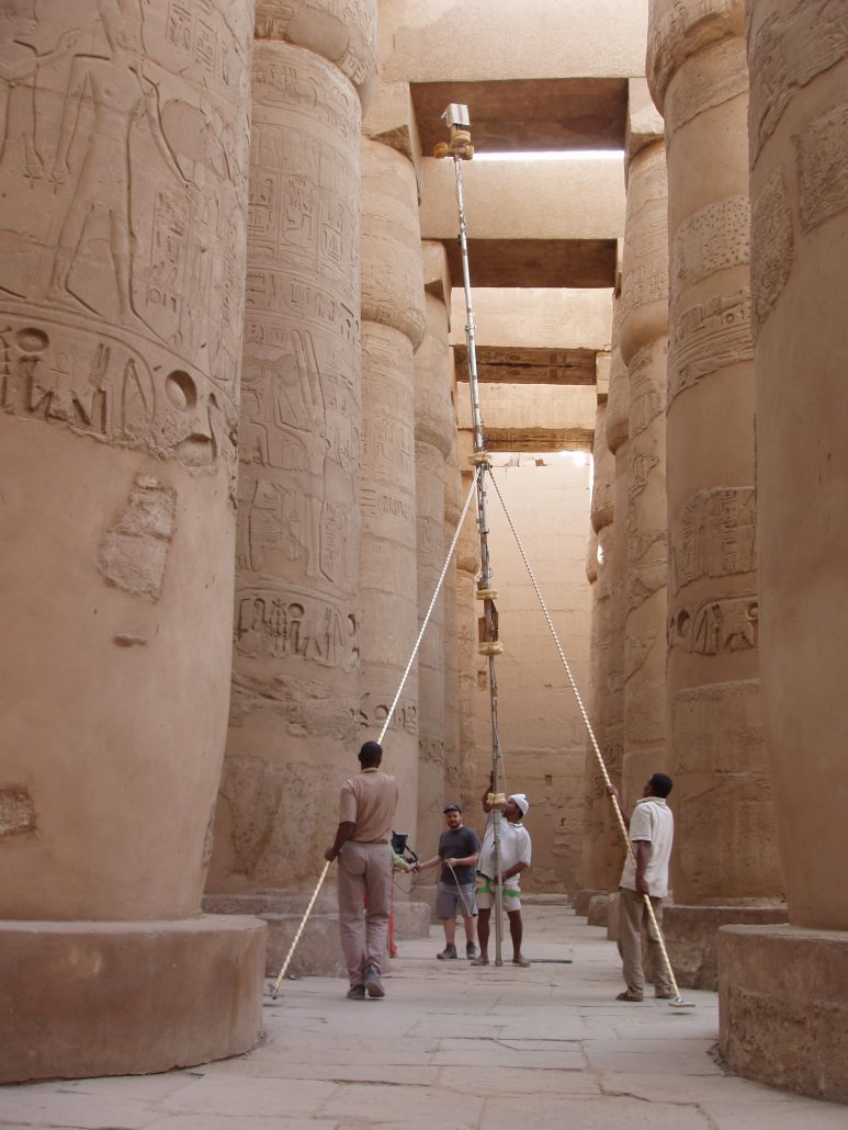
After a first 3D scanning operation 10 years ago, a complete photogrammetric coverage was carried out in 2008. In order to produce orthophotos with a 2.5mm pixel (over an area of nearly 15,000 m2), the columns were covered by nearly 4500 convergent metric photographs taken with an 8 meter pole. The shooting and its exploitation proved to be very complex, because of the geometric constraints (small space between the columns, continuity of the visits) and radiometric (photography of each sector of the columns at different periods to avoid the direct lighting).
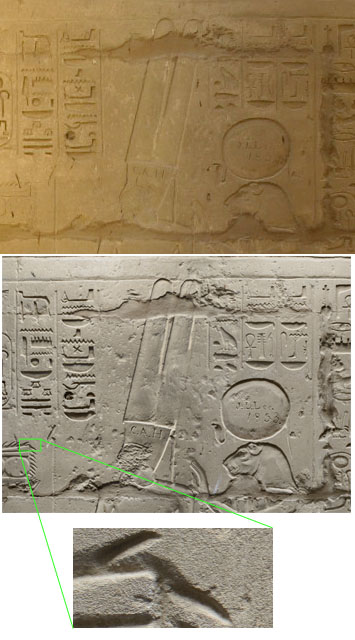
These medium-resolution orthophotos make it possible to see at a glance the entire surface of the columns. It is mainly useful for architectural studies, and can also be used as atlas for epigraphic data. But its resolution is insufficient for the epigraphic study itself, and especially for the search for palimpsests, that is to say the traces of decorations or inscriptions prior to the last state of the hypostyle hall, that several pharaoh of the XXIXth Dynasty (notably Ramses II) have recapured.
To achieve this goal, it was necessary to specify a much higher resolution shooting. Together with the Egyptologists of the team, after several tests of legibility on test zones, we chose a pixel size of 0.25 mm (while being aware that this would represent a work 100 times higher than the average resolution that we had already had so much trouble carrying out …). At first, only the engraved scenes representing the deities were treated, a height of about 3m30. Each column portion concerned was photographed by 7 rings of 16 images, made by artificial lighting (flashes) from a telescopic scaffolding (the area to be treated being relatively close to the ground). The georeferencing of these images was obtained by measuring characteristic points from the medium resolution models. The photography operations are now complete, and the calculation of the orthophotos is programmed according to the priorities of the Egyptologists.
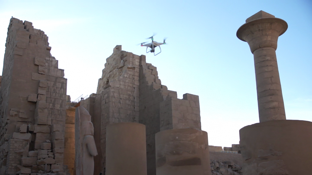
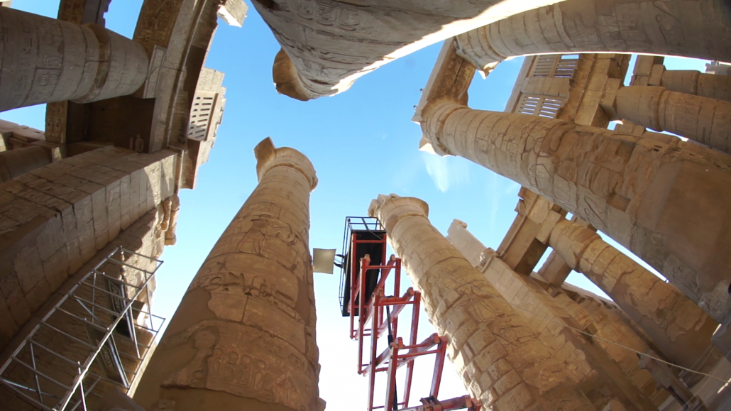
But there remained a undocumented part of the edifice, and indeed even virtually unknown: the higher parts, above the capitals, the abacuses, architraves and claustra, barely visible from the ground, and nevertheless decorated as carefully as the rest of the building. Access, where it is possible, is very dangerous, and because of the collapse of the ceilings, many areas are completely inaccessible (at least since the beginning of the XX century, when the room was backfilled to allow the reassembly of columns collapsed in 1899).
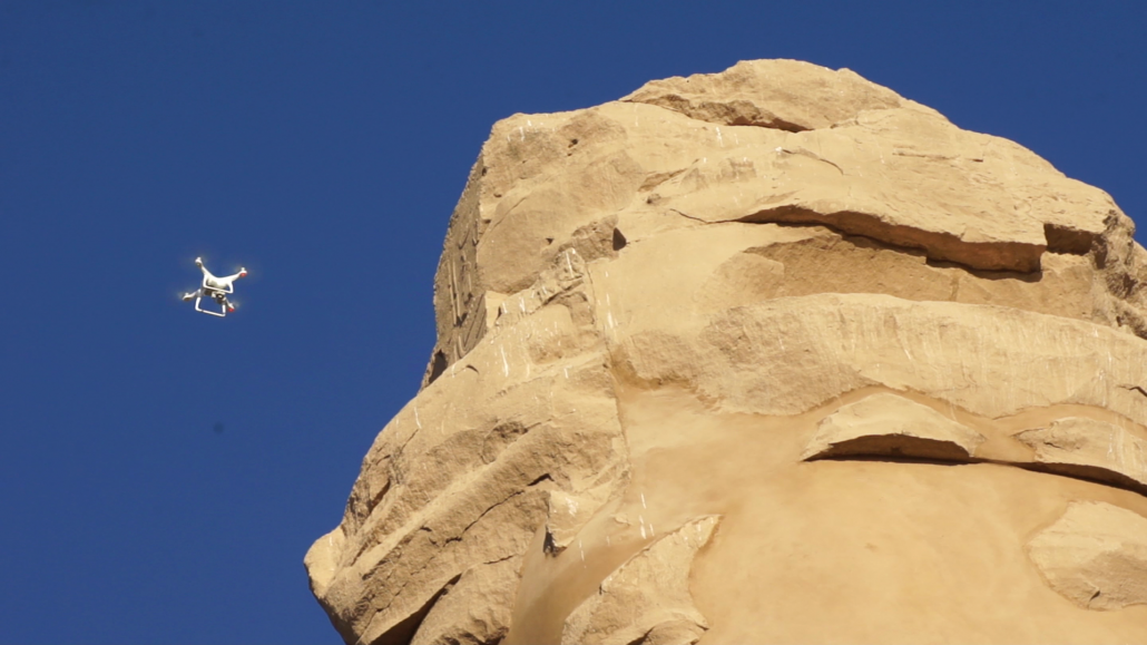
Fortunately, the 2017 mission has been authorized to use a drone to photograph in a very detailed way the upper parts of the room, with systematic horizontal and vertical shots. Thirty flights of 20 minutes (battery life) were performed every morning at the same time, the time when the direction of the sun changes the least (and incidentally where the tourist flow is the lowest). All these flights were made a few meters from the masonry, in manual control, space congestion making predefined flight plan to dangerous. Needless to say, the pilot’s task was tough! This very exhaustive campaign (in intervallometric mode, a photo every 2 seconds) has enabled the acquisition of twenty thousand images, whose georeferencing is ensured by a re-installation of the markup of the network of 2008, visible on vertical axis images.
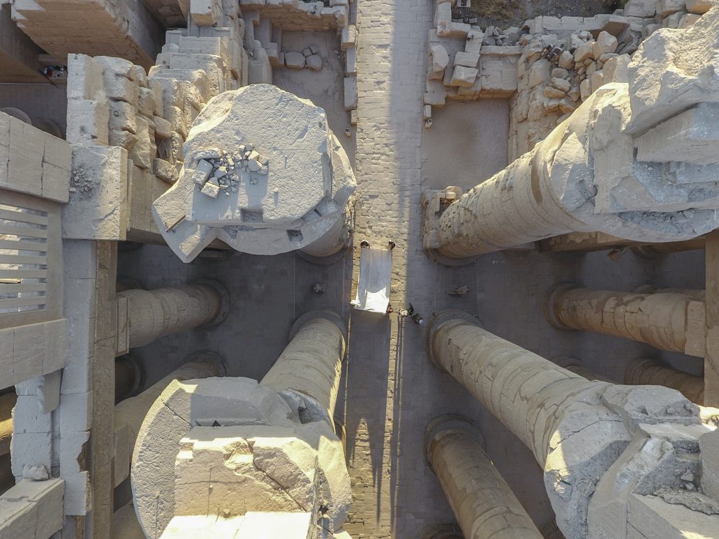
The meeting of all these sources of documentation acquired over the last ten years can now serve as a basis for architectural, historical and epigraphic research.
This mission gathered in Karnak in December 2017:
- Owen Murray (Canada), photographer, drone pilot
- Emmanuel Laroze (France, CNRS) architect
- Yves Egels (France, IGN / ENSG) photogrammetre
as part of the Great Hypostyle Hall project.
Yves Egels
yves.egels@free.fr
www.memphis.edu/hypostyle
ENSG training at the Château de Murol : photogrammetric survey – and more
After the collegial church Saint-Ours of Loches in Touraine (see Newsletter #12, May 2017), the medieval fortress of Murol became the training ground for the ENSG students from the postgraduate specialization course in Photogrammetry Positioning and Measurement of Deformations (PPMD).
Erected on an isolated prominence in the French Massif Central, made of the local black volcanic stone typical of the constructions around Clermont-Ferrand, full of apartments, rooms, crannies, passages, stairs, battlements, the castle makes an austere and forbidding sight and, when you are photogrammetry-minded, a difficult edifice to survey and model. Encouraged by the genial welcome and help of the municipality, and by a spell of warm and sunny weather exceptional even for an October Indian summer, the students’ expertise-in-the-making and creativity resulted in a fully georeferenced survey of the general structure and of many parts of the fortress.
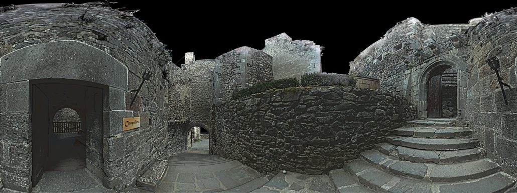
360°view of passageways and stairs in the Château de Murol (photographic image and lidar scan combined)
In two weeks, the 21 students of this 2017-2018 class and their supervisors (some from the École Nationale des Sciences Géographiques, some from the French national mapping agency, IGN) set up a local topographic network and established the transform parameters to make it compatible with the French national reference system RGF93. They acquired some 2 600 images from well-planned vantage points, the cameras being held by hand, or fixed on tripods, on masts or aboard drones. Operating two terrestrial lidar sensors conjointly, the PPMD students cumulated a total number of 65 scans.
The ramparts of the Château de Murol suffer in places from water penetration. In addition, under the pressure exerted by the weight of the upper parts, swellings appear at sporadic places in the walls, and masonry stones can be, slowly but surely, forced out. These observations prompted two specific workshops: how to use a robotic tacheometer for deformation monitoring, and how to use a thermographic camera and remote-sensing techniques to provide complementary evidence on the seeping issues.

The fortress of Murol, drone-eye view
Scanned, photographed, monitored – most of the Château de Murol was captured into georeferenced data made fit for precision modelling. The first results were shown to the town officials in charge of the historical heritage at the end of the second week, before leaving. There again, the PPMD students were at the forefront!
Jean-Francois Hangouët
jean-francois.hangouet@ensg.eu
www.ensg.eu
CIPA, ICORP and ISCARSAH Joint Meeting
December 9th, 2017, New Delhi (India)
The 19th General Assembly and Scientific Symposium of ICOMOS with main theme Heritage and Democracy took place in New Delhi, India on 8-15 December 2017. This great and important event takes place every three years. The ICOMOS General Assembly and the Scientific Symposium provides a great opportunity for heritage professionals and enthusiasts to come together on a common platform to deliberate on various aspects of heritage conservation and management. More than 1,500 experts on Cultural Heritage protection, members of ICOMOS from 84 countries participated in this great event.
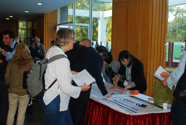
Registration desk
CIPA undertook the initiative to organize a joint meeting of three ICOMOS ISC’s as a side event on December 9th, 2017. This initiative was based on a long tradition of our Committee in reaching out to all other ICOMOS ISC’s and foster collaborations. The collaboration with ICORP (International Committee for Risk Preparedness) started years ago, but it was in 2016 that the decision was taken to organize a joint meeting in New Delhi.
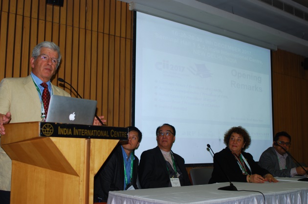
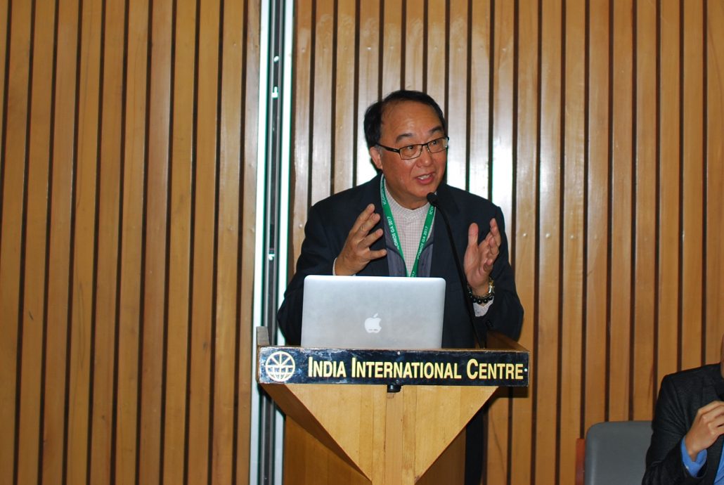
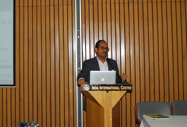
Opening remark by Prof. Andreas Georgopoulos
Natural and human-induced disasters have caused and are still causing huge losses of Cultural Heritage worldwide. After disasters, information concerning the state of cultural heritage is essential. The members of CIPA and ICORP are very concerned and actively participated in all related events in the last years. A close cooperation between the related ISCs would be more beneficial for the conservation and protection of cultural heritage. This idea was discussed with two presidents of CIPA, ICORP and received a highly positive response.
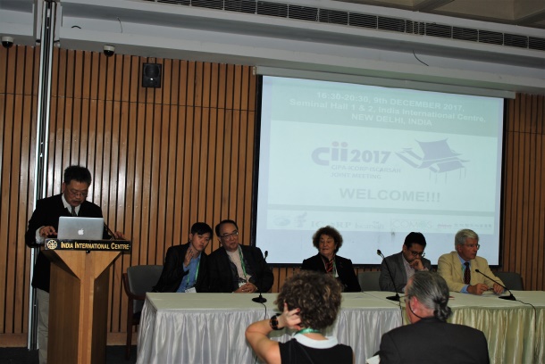
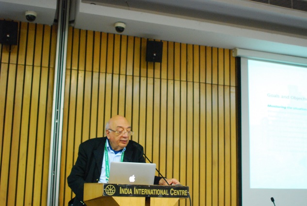
Opening remark by Prof. Ya Ning Yen
In order to share the information of cultural heritage conservation and coordinate protection efforts, CIPA working cooperatively with ICORP decided to invite also ISCARSAH (International Scientific Committee on the Analysis and Restoration of Structures of Architectural Heritage) and hold a joint meeting during the 2017 19th ICOMOS General Assembly in New Delhi, India. ICORP enhances disaster risk management and resilience for built cultural heritage; ISCARSAH serves as a network for experts in the field of conservation of heritage structures. Individually, they have been successful in their efforts to protect cultural heritage through conducting research, developing conservation theory, holding international conferences and training activities. According to ICOMOS principles, cross-disciplinary collaboration between ISCs has been encouraged.
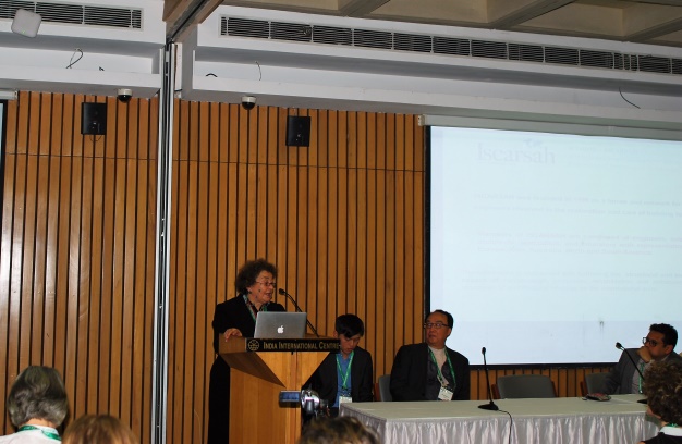
Opening remark by Prof. Gorun Arun
The idea of the three-ISCs collaboration can be traced back to April 2016. Afterward, in August, part of the members of the board, Professor Andreas Georgopoulos, Professor Mario Santana and Professor Alex Yen, Dr Rand Eppich, and Gustavo Araoz, President of ICOMOS, made an initial discussion and drafted a proposal. The partnership of the three ISCs was officially confirmed during the meeting of ICOMOS 2016 General Assembly in Istanbul in October 2016. Through the close collaboration, CIPA, ICORP and ISCARSAH aimed to share the resource such as research results and experts, making the network of cultural heritage conservation extended.
Opening remark by invited guest Mr Gwo-long Shy
The achievements of this cooperation have been highly appreciated. To promote the cooperation, CIPA, ICORP and ISCARSAH have each appointed two representatives respectively; Professor Mario Santana and Professor Alex Yen were on behalf of CIPA. The preparations for the 2017 joint meeting were done by Professor Alex Yen and China University of Technology.
Keynote speaker: Dr. Samir Abdulac
The meeting was very well organized, and the attendance was beyond expectations. Many international colleagues responded to the Call for Papers and the abstracts submitted were reviewed by an international scientific committee.
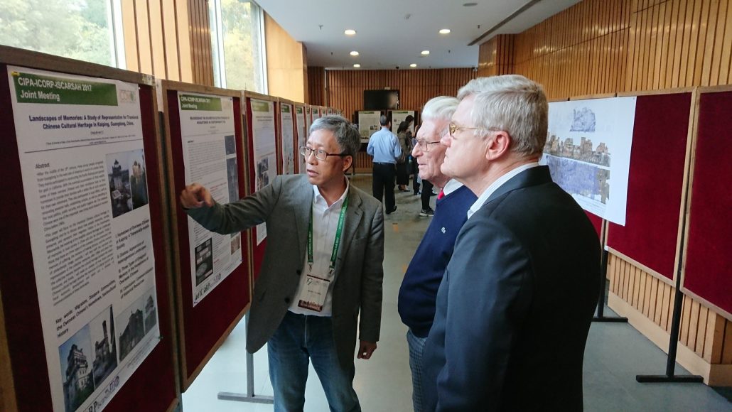
Posters display I
The 32 papers (10 oral and 22 posters) finally accepted for presentation to the CII2017 on cultural heritage studies are cross-disciplinary each covering topics on at least two fields of CIPA, ICORP and ISCARSAH. Topics of interest include, but are not limited to, the following areas:
- Research trends, results and findings
- Integration platform
- Education and knowledge dissemination
- Public participation and engagement
- Case studies for application
- Possible collaborations of ICOMOS International Scientific Committees for the future
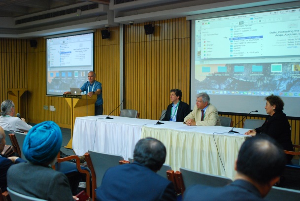
Closing session (Prof. Mario Santana)
Approximately one hundred experts from 18 countries attended this unique event. The meeting was moderated by the main organizer, Prof. Ya Ning Yen, who is a member of the EB od CIPA, and an introductory speech was delivered by Prof. Mario Santana (CIPA Vice President). The three ISC Presidents (Prof. Andreas Georgopoulos, Dr Rohit Jigyasu and Prof. Gorun Arun addressed the participants on behalf of their Committees. The proceedings were available for the participants in situ in electronic form and are available on the ISC’s web pages.
Keynote speaker: Mr. Kamal Kishore
Andreas Georgopoulos and Alex Yaning Yen
president@www.cipaheritagedocumentation.org and alexyen@cute.edu.tw
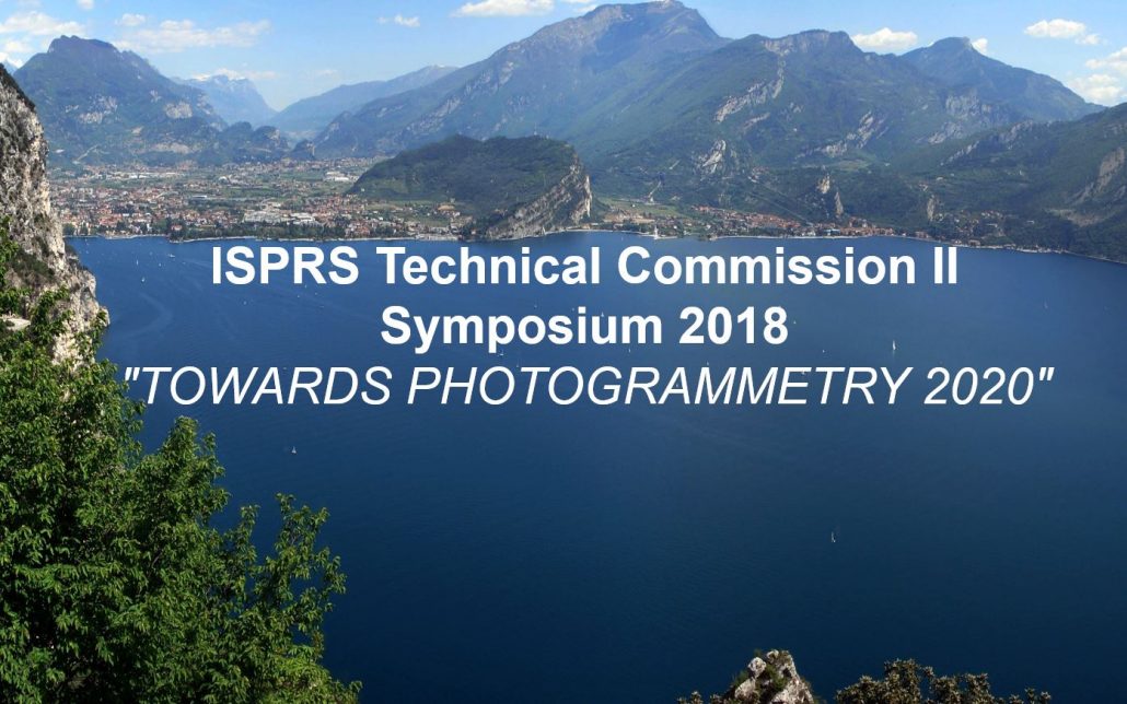
Invitation to join ISPRS TCII mid-term Symposium “Towards Photogrammetry 2020”
June 3-7, 2018, Riva del Garda (Italy)
The ISPRS TC II mid-term Symposium will be held in Riva del Garda (Italy) on 3-7 June, 2018 (see website). ISPRS TC II focuses, at various scales, on geometric, radiometric and multi-temporal aspects of image- and range-based, 3D surveying and modelling. The mid-term Symposium will feature an initial day of tutorials, 4 days with plenary and parallel sessions and an exhibition of the most important business players in the photogrammetric domain.
There will be 4 invited speakers covering all aspects of the Photogrammetric and Geospatial fields: Jantien Stoter (3D Geoinformation group, Delft University of Technology, The Netherlands) on “Designing, developing and implementing better systems to model 3D cities, buildings and landscapes”; Davide Scaramuzza (Robotics and Perception group, University of Zurich, Switzerland) on “Autonomous, Agile, Vision-controlled Drones: from Active to Event Vision”; André Streilein (Swisstopo, Switzerland) on “National mapping agencies in a changing period”; Camillo Ressl (Department of Geodesy and Geoinformation, Photogrammetry group, Technical University Vienna, Austria) on “Investigating Dense Image Matching”.
The event will be organized by FBK Trento in collaboration with ARIDA (Association for Real-time Imaging and Dynamic Analysis), JSPRS (Japanese Society of Photogrammetry and Remote Sensing) and SIFET (Italian Society of Photogrammetry and Topography).
The venue of the event is a beautiful small city on the Garda lake, the largest lake in Italy. The mild climate of Riva del Garda favors a typically Mediterranean vegetation with lemon trees, olive trees, laurels and palm trees: a true Mediterranean island at the foot of the Dolomites. The center of Riva del Garda will fascinate you with its works of art and architecture, witnessing to ancient history and a past rich in art and culture.
On behalf of the symposium organizing committee, we are looking forward to seeing you in Riva in June 2018.
Fabio Remondino
remondino@fbk.eu
www.isprs.org/tc2-symposium2018
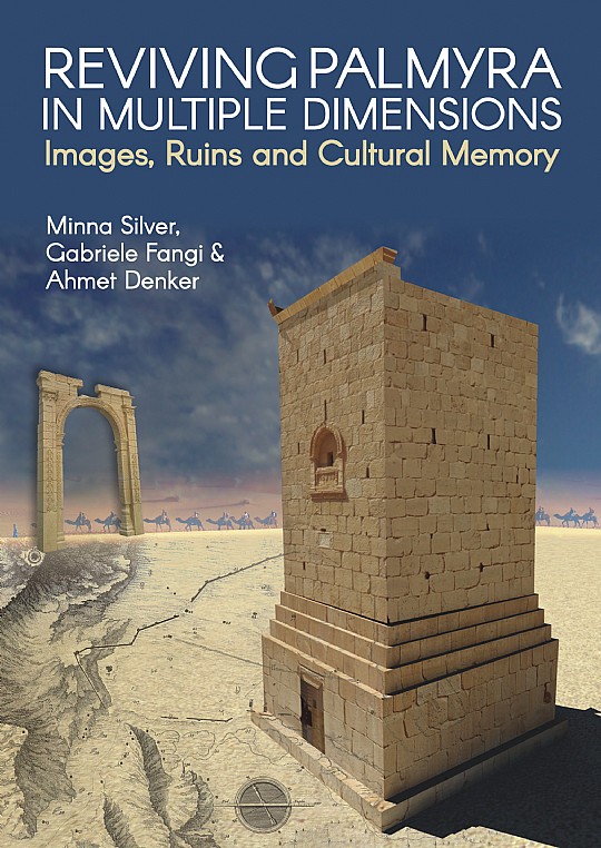
Reviving Palmyra in Multiple Dimensions. Images, Ruins and Cultural Memory
Silver, Minna; Fangi, Gabriele; Denker, Ahmet (ISBN 978-184995-296-5)

This book provides a visual reconstruction of Palmyra, a World Heritage Site situated in Syria, which flourished in Greco-Roman times. Palmyra is situated in a desert oasis and served as a vibrant caravan station on the Silk Road connecting the Roman world with the East. It has been called ‘the Queen of the Desert’ and ‘Venice of the Sands’.
In 2015–2017 the city was conquered by ISIS who destroyed its monuments and museum, also killing several of its inhabitants. Their aim was to erase the memory and identity of the place, its people and our common heritage. However, through the use of modern technology including photogrammetry, digital imagery and 3D modelling, it has been possible to recreate the documented monuments, thus overcoming to some extent the trauma, cultural destruction and loss.
The book unveils the rediscovery of the site by the West and revives and reconstructs the ancient city through images and history. The reader is taken through the spectacular city and its past by providing the information to follow the roots and development of the site, its monuments and its people through the ages, including rulers such as Queen Zenobia. The combination of visualization and written accounts interlink the environment and its people, the monuments and archaeological small finds by using ancient written sources, old photographs, new imagery, 3D models and 3D printing. Thus this ancient site and its past is revived in multiple dimensions.
Key features
- a classic example of digital archaeology and virtual reconstruction;
- provides a comprehensive and fascinating study of Palmyra, lifting it from the ruins;
- a beacon for the recording of international cultural heritage.
Contents
Introducing the memory of the place; Approaching Palmyra from air, space and by land; Revealing cities beneath cities; Individual, families and tribes in inscriptions and images; Palmyra’s destiny between Rome and Persia; The Temple of Bel at the core of Palmyra; The Triumphal Arch and the Grand Colonnade; Sacred and public spaces along the Grand Colonnade; The tombs for the eternal souls of Palmyreans; The Camp of Diocletian, the Christian Basilicas and the Arab Citadel; Appendix – The documentation of the architectural heritage by spherical photogrammetry.
Readership
Ideal for all who have an interest in archaeology or the application of modern geomatics and digital techniques in its preservation. Professionals and students in archaeology, heritage and conservation, museums and related areas will find it interesting and stimulating as will anyone in geomatics involved with the application of such techniques to recording heritage.
Agisoft PhotoScan projects
Agisoft LLC (www.agisoft.com) is an innovative research company with a focus on professional photogrammetric software development. Agisoft PhotoScan, being run on a single desktop computer (Windows, Linux, Mac OS) or on a cluster for massive data management, enables the user to process digital images into the accurate spatial data, like Dense Point Clouds, Textured Polygonal Models, Georeferenced True Orthomosaics and DEMs.
Agisoft PhotoScan software presents diverse and advanced functionality making the tool popular among the professionals in various fields. An international team of underwater archaeology surveyors from the Universities of Nottingham, Ain Shams and Alexandria, for example, have collaborated through 2017 to digitally record S.S. Thistlegorm shipwreck, laying under 32 m of water in the Red Sea. The resulting accurate 3D models cover 28689 sq.m. of both the external and internal areas of the site featuring every detail. Over 600 historical sites have been documented around South America, including the world-known Machu Picchu city, by Peru’s drone archeology team, who has chosen PhotoScan software for the imagery processing. Taiwan’s National Cheng Kung University applied photogrammetry for the project of a different nature – inspection of the damage caused by an earthquake in Taiwan, February 2016.
Furthermore, urban management tasks are effectively solved with 3D models reconstructed for the entire cities, like the one generated for the city of Tomsk, Russia (320 km², 2014). Among the recent agricultural user cases, the project held in Central Russia can be named as an example of vegetation index calculation large-scale tasks (1000 ha, 2015).
While all the kinds of applications mentioned above are accuracy-focused, PhotoScan is also employed in the fields where texture quality matters, namely, game design and visual effects industries. Detailed 3D models of natural and artificial assets generated in PhotoScan are widely used for environmental design (such as Redwood forest by MAWI United). Popular computer games (Star Wars Battlefront by EA Dice, The Vanishing of Ethan Carter by The Astronauts, The Talos Principle by Croteam) and films (Mad Max: Fury Road by Iloura, Edge of Tomorrow by Sony Pictures Imageworks, Lincoln by Framestore), have proven that PhotoScan photogrammetric software becomes an indispensable part of a designer’s work.
The Agisoft team constantly works on improvements for PhotoScan software to be an efficient solution for the tasks our users face.
Diana Ovod
diana.ovod@agisoft.com
www.agisoft.com
AICON 3D Systems at the CAA in Tübingen (Germany)
From March 19-23, 2018 the 46th CAA will focus on “Human history and digital future”. This international conference will bring together scholars from across the globe to share their cutting-edge research from a diverse range of fields.
Dirk Rieke-Zapp, AICON Key Account Manager Arts & Culture, will co-organise the workshop W5 on “Close range 3D data acquisition and analysis” with Hubert Mara (University of Heidelberg) and Paul Bayer (University of Graz). The workshop is split in two parts:
- Hands-on experience with different close range 3D scanning methods;
- Analysis and comparison of data using Gigamesh software.
In addition, the company AICON 3D Systems will present the scanner line PrimeScan, an attractive entry-level solution for highly precise digitisation for applications in arts and cultural heritage. The PrimeScan is compactly designed: Its base area equals a DIN A4 sheet, the scanner weighs only 3 kg. With its short working distance, it is suitable as desktop solution and for applications with limited room. Measuring fields between 50 mm and 1,000 mm are available, the working distance is optimised for the spatial conditions of museums as well as of archaeological excavations.
AICON 3D Systems is the only manufacturer of high-end scanners with blue and white projection light, suitable for scanning all surface colors. A PrimeScan configuration with color cameras captures high-resolution image textures. The OptoCat Texture Mapping module allows mapping these data directly to the 3D models. Depending on the required resolution at the object and the favored accuracy, the PrimeScan cameras (monochrome or color) are available with resolutions of two, five or eight megapixel.
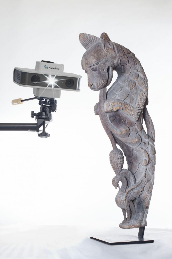
High-resolution 3D data of the European sabre-toothed cat’s teeth and bones
The curved canine tooth serves as namesake — and its length of more than 10 cm indicates at the same time that you cannot compare the extinct European sabre-tooth cat with today‘s domestic cat: The bone and tooth remains found in Schöningen (Germany) belonged to a young animal with a shoulder height of approximately 1.1 meters and about 200 kilograms weight. Nowadays, this physique corresponds to the body of a lion or a tiger!
Tactile measuring techniques only partially suit for delicate fossil objects that might be damaged by the probing. For the contact-free digitization of the finds, the SmartScan is applied. Thanks to its modular configuration using black-and-white or colour cameras in varying resolutions, this AICON white-light scanner allows for exact adjustment to the requirements of users and their projects.
The AICON SmartScan captures the very sensitive paleontological finds in a contact-free, fast, and highly precise way. Using the digital representation for research protects the precious object. The 3D scan data even allow for more detailed analyses of the dental enamel‘s surface than the original object.
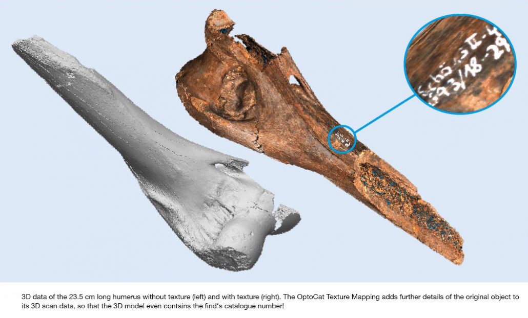
The texture mapping can be carried out both by using the internal imagery of the AICON SmartScan as well as using images taken with any kind of external camera. Working with external digital data not only allows for a variety of possibilities of texture capturing but also provides a large degree of freedom with regard to pixel resolution, professional illumination and raw data processing with colour management. Furthermore, it is possible to complement the 3D data generated by a monochrome scanning sensor with colour imagery, or even to work with multispectral data (UV, IR, etc.).
With the OptoCat Texture Mapping module, the 3D model gets an improved colour reproduction, a clearer contrast and a higher texture resolution — and therefore reaches a much more realistic representation of the original object than the scanner cameras‘ mere vertex colours.
Read more about the advantages of and the workflow with an AICON Scanner.
Dirk Rieke-Zapp
ac_newsletter@aicon3d.de
www.aicon3d.com
Berlin Philharmonic Concert Hall in 3D
In cooperation with the Getty Museum in Los Angeles, the Fraunhofer IGD’s Competence Center for Cultural Heritage Digitization captured the entire interior of the Philharmonic Concert Hall in Berlin. The first step was to create a detailed 3D model which was then turned into a realistic 3D print. This final print was on view at the exhibition Berlin/ Los Angeles: Space for Music in summer 2017.
The curators decided to make use of 3D scanning technologies while planning this exhibition. The Getty aimed at displaying selected objects from the recently acquired collection of the star architect Frank Gehry for the first time. At the same time, the exhibition celebrated the 50th anniversary of sister-city partnership between Berlin and Los Angeles.
Amongst the selected objects was a model of Gehry’s Walt Disney Concert Hall in Los Angeles. For the conception of this building, Gehry devoted himself to the study of Hans Scharoun’s concert hall in Berlin. Consequently, it was necessary from a curatorial point of view to present the two renowned concert halls in direct opposition. In order to bridge the distance between LA and Berlin, the curators agreed to draw on 3D digitization technologies.
Pedro Santos’ team is specialized in the digitization of cultural heritage and only shortly before, it had scanned the monumental Pergamon Altar in 3D. The concert hall of the Berliner Philharmonic, however, turned out to be one of the most challenging scanning project yet. To realize the curators’ vision, researchers from the department travelled to Berlin to capture the building with a laser scanner. This scanner’s rays are reflected by a mirror which rotates in vertical and horizontal directions. By this means, it can record 3D points in a 360° environment. For the acquisition of the interior it was placed in 98 different positions. In this way, the team succeeded in digitizing the complex concert hall in detail.
This project is a fascinating demonstration of the potential that 3D digitization holds for the cultural heritage sector.
For more information visit Getty Around the World.
RIEGL wins MAPPS Geospatial Excellence Award
For technology innovation at the 2018 MAPPS Winter Conference
On Wednesday, January 31, 2018, RIEGL became the proud recipient of the 2017 MAPPS Geospatial Products and Services Excellence Award. This prestigious award was bestowed upon the RIEGL miniVUX-1UAV miniaturized LiDAR sensor for unmanned laser scanning in the Technology Innovation category at the 2018 MAPPS Winter Conference!
The RIEGL miniVUX-1UAV is a user-friendly and cost-efficient device to acquire survey-grade measurement data by use of remotely piloted multi-rotor, rotary-wing, or fixed-wing UAVs for a variety of applications.
The RIEGL miniVUX-1UAV provides high-speed data acquisition using echo signal digitization and online waveform processing, based on RIEGL’s sophisticated Waveform-LiDAR technology. Its excellent multiple target capability achieves superior measurement results, the 360° field of view allows complete acquisition of the environment, and its well-designed housing supports mounting, even with restricted weight and space requirements.
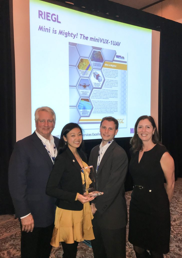
The team of RIEGL USA proudly presenting the MAPPS Geospatial Excellence Award for Technology Innovation
My-Linh Truong, ULS / UAS Segment Manager at RIEGL USA, states, “The response of the miniVUX-1UAV LiDAR sensor introduction to the commercial UAV market has been overwhelmingly positive. The flexible and compact nature still maintains the high-performance LiDAR excellence that RIEGL is known for in the surveying and mapping industries. The miniVUX system enables our clients to easily expand or enhance their services in the ever growing and evolving geospatial marketplace.”
The MAPPS awards competition recognizes the professionalism, value, integrity, and achievement that member firms have demonstrated in their projects and technology developments over the previous year.
RIEGL is thrilled to be the winner of the MAPPS Geospatial Excellence Award!
About RIEGL
- RIEGL is an international leading provider of cutting edge technology in airborne, mobile, terrestrial, industrial and unmanned laser scanning solutions;
- RIEGL has been producing LiDAR systems commercially for almost 40 years and focuses on pulsed time-of-flight laser radar technology in multiple wavelengths;
- RIEGL’s core Smart-Waveform technologies provide pure digital LiDAR signal processing, unique methodologies for resolving range ambiguities, multiple targets per laser shots, optimum distribution of measurements, calibrated amplitudes and reflectance estimates, as well as the seamless integration and calibration of systems;
- RIEGL’s various 3D scanners offer a wide array of performance characteristics and serve as a platform for continuing ”Innovation in 3D” for the LiDAR industry;
- From the first inquiry, to purchase and integration of the system, as well as training and support, RIEGL maintains an out-standing history of reliability and support to their customers;
- Worldwide sales, training, support and services are delivered from RIEGL’s headquarters in Austria, main offices in the USA, Japan, and China, and by a worldwide network of representatives covering Europe, North and South America, Asia, Australia, and Africa.
For more information, visit the RIEGL website.
Silvia Zaiser
szaiser@riegl.co.at
www.riegl.com

