Newsletter 13
October 2017
Editors view
Dear All,
“Digital Workflows for Heritage Conservation” the 26th CIPA symposium belongs to the past. From August 28 to September 1, 2017, 380 participants from around the world participated in this CIPA biannual event. Carleton University and the Carleton Immersive Media Studio, namely Mario, Stephen, Christian, Michelle, Laurie, James and the volunteers did their best to host a successful international event. During CIPA 2017, the Executive Board decided to organise the next CIPA (2019) symposium in Avila, Spain.
Before CIPA 2017 in Ottawa, CIPA organised the 4th summer school in Pafos, Cyprus from July 12 to July 18, 2017. The school hosted 19 participants from 12 different nationalities. Theoretical lectures on 3D surveying, image-based modelling, photography and laser scanning as well as practical work, both in-situ and in the lab, took place. Social programme was also an important component of the school since Pafos is the European Capital of Culture for 2017.
CIPA newsletter is open to the cultural heritage community, to announce or publish news and articles, projects, books, etc. related to cultural heritage. Do not forget that we do count on your support.
Enjoy reading our new e-newsletter!
Stratos Stylianidis, Geert Verhoeven
Efstratios Stylianidis
Geert Verhoeven
stratos@geoimaging.com.cy
The CORONA unclassified satellite photographs: a data source in archaeological prospecting
A new triumph has been achieved in archaeological prospection by using remote sensing. The lost city of Qalatga Darband in Iraqi-Kurdistan has recently been identified and believed to have been founded in the aftermath of the visit by Alexander the Great in 331 BC. A team of Iraqi and British archaeologists found the site that was initially discovered by using CIA’s declassified satellite photographs from the 1960s. Drones were used for delineating buildings of the ruined city (The Times, Independent and IFLScience 25th September, 2017).
The so-called CORONA unclassified satellite photographs from the 1960s have served as a valuable data source for archaeologists working in the Near East. These black and white satellite photographs from the archives of CIA had been produced in the Cold War years. The first satellite film from space was recovered in 1960 and revolutionized intelligence serves. The data from the CORONA missions became available to the public when President Clinton released them to market in the 1990s. Soon they were used by archaeologists. The spatial resolution of the photographs can reach 1.8 m. The photographs are cheap, and they provide data of monuments and sites that can have disappeared or lost visibility under such forces as desertification, agriculture, and building. In addition, they can reveal environmental conditions that prevailed 50 years ago.
In the areas, like the Near East, desertification is an acute problem and changes in the environment take place in decades. The lost city of Ubar was detected by satellite images under the sands in the Near East in the 1990s. The Finnish project SYGIS in Syria led by the present author since 2003 and the Finnish-Swedish project in Mesopotamia has used CORONA photographs in Turkey in recent years. In the Finnish project SYGIS apart from Roman sites and roads ancient gardens and irrigation canals were traced in the desert environment at the Ummayad castle of Qasr al-Hayr ash-Sharqi (Figs. 1. and 2.) northwest of Palmyra. Also, changes in the Bedouin habitation, either in tent camps and sedentary villages could be detected. The neighbourhood including the small township of Taibeh (Fig. 1.) has been under the control of ISIS in recent years.
The Finnish-Swedish project in Mesopotamia has used satellite imagery in prospecting sites in the Roman Limes, the acquired CORONA photographs have helped to understand the terrain in the mountainous regions.
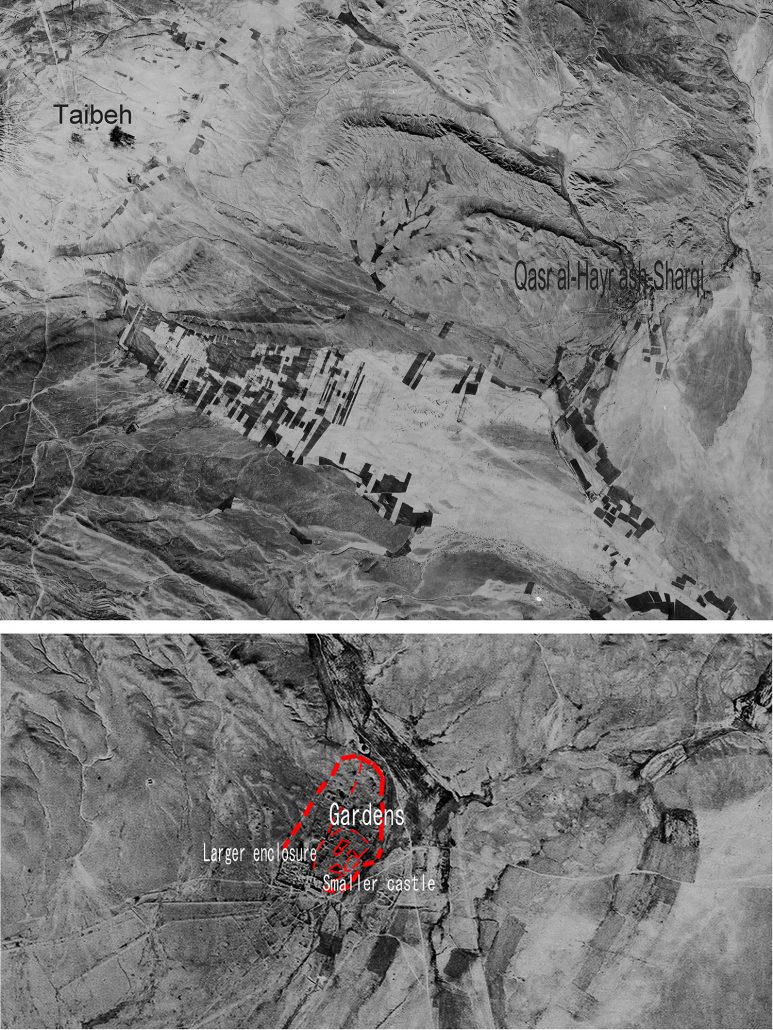
CORONA declassified photographs from the 1960s showing the ancient sites of Qasr al-Hayr ash-Sharqi and Taibeh in Syria northwest of Palmyra. Mapping by Minna Lönnqvist (present Silver)
Minna Silver
mlonnqvi61@hotmail.com
International Conference on “Digital Encounters with Cultural Heritage”
+ Workshop on Research and Education in Urban History in the Age of Digital Libraries, Saxon State and University Library Dresden (SLUB), Germany, 30th-31st March 2017
The international conference under the patronage of CIPA was organized by Kristina Friedrichs (Würzburg), Sander Münster (Dresden), Florian Niebling (Würzburg) and Agnieszka Seidel-Grzesinska (Wroclav).
On march 30th and 31st the joint event of the Technical University Dresden and the University of Wroclav took place in Dresden, namely the “Conference on Digital Encounters with Cultural Heritage” and the “Workshop on Research and Education in Urban History in the Age of Digital Libraries”. On both days scholars from 14 nations presented their work on urban history and digital methods.
After the introductory speech of Sander Münster, the president of CIPA, Prof. Andreas Georgopoulus gave the first keynote and thus, the start of the conference. In his lecture, he introduced CIPA’s perspective on cultural heritage and its digital development.
Already the first session on art, history and culture showed how strongly digital methods are integrated into the urban space exploration. The contributions also illustrated the pleasingly wide range of possible research questions. For example, TABEA LURK, MARKUS SCHWANDER and DANIEL BREFIN (Basel) reported on the project “Grenzgang”, which illumined the perception and mediation of (urban) space from the perspective of artistic walking tours. In her presentation, CLAARTJE RASTERHOFF (Amsterdam) showed how cultural events, music, theaters, exhibitions and others can be examined by computer-assisted analysis regarding their influence on the city. Amsterdam served as an example. AGNIESZKA SEIDEL-GRZESINSKA and MAŁGORZATA WYRZYKOWSKA (Wroclaw) retraced the historical development of monuments with special consideration of Silesia and informed the audience about the current integration of the material into their digital repositories. DANIEL ISEMANN and TUAN ANHAN (Regensburg) dealt with the artists of the Dutch genre painting in the 17th century and their creative exchange between individual urban centers in the manner of a spatial network analysis.
In the session on image databases, the different requirements for such repositories as well as user-centered technological approaches were discussed; the contributions aimed at both, the scientific and the interested lay public. BEATE LÖFFLER (Duisburg) presented the project “ArchiMediaL” that is working on the evaluation of urban photographs and postcards from image repositories and databases. It focuses on crowdsourcing and automatic image recognition, which is of outstanding relevance due to the non-European research field Japan. The talk of CHRISTINA KAMPOSIORI (London) dealt with the use of digital image archives by art and architectural historians, with a particular focus on an analysis of their search behavior. She presented the results of a qualitative survey that also revealed the main deficits of the existing digital platforms. JOANNA ZĘTAR (Lublin) spoke about the work of the cultural institution Brama Godska – Teatr NN that is based in Lublin. In addition to the image repository located there, the focus is on the use of computer-aided models, augmented reality applications and narrative media in the public mediation of city history.
A session devoted to VR and AR technologies showed the advantages of computer-aided models and the use of different realities, but also addressed the deficits of these approaches. For example, ANDREA GIORDANO and PAOLO BORIN (Padua) dealt with the spatial and temporal components of urban models based on their specific example Venice. In addition to the methodological challenges, they discussed technological approaches to computer-aided visualization using a four-dimensional model. RADEK FIALA (Pilsen) introduced the case study of the Peregrinus Silva Bohemia Project, which focuses on the transfer of architecture and cultural space through interactive maps, 3D models and augmented reality, with a special focus on the didactics that are changing due to the technical solutions used. Regarding the technical aspects of virtual realities, BRUNO FANINI and EMANUAEL DEMETRESCU (Rome) formulated specific guidelines that can lead to an increased immersive experience when creating VR presentations.
The first day of the conference concluded with a keynote by STEPHAN HOPPE (Munich) in which he focused on digital methods for the analysis of architecture. He also strongly advocated for the use of open formats such as Wikidata. On the second day of the conference, LEONID BORODKIN (Moscow) held another keynote that discussed the virtual reconstructions of Moscow monasteries and show how, in addition to the pure digitization of data, they could also be used as a tool for scientific evaluation during the reconstruction.
A longer session devoted to digital reconstructions showed on the one hand the chances of research and mediation through this medium, but on the other hand also formulated the clear desideratum of uniform guidelines and standards. MIEKE PFARR-HARFST (Darmstadt) therefore talked about the current challenges in working with digital 3D reconstructions, especially for urban structures, and how these can be overcome by the development of binding standards that go beyond the current practice. Furthermore, HENDRIK HEROLD and ROBERT HECHT (Dresden) reported on the reconstruction of urban space on the basis of historical maps, with a focus on settlement structures and pattern recognition. In addition, the visualization of these special results was discussed. The contribution of EMANUEL DEMETRESCU (Rome) introduced a tool for documenting the sources that were used for a virtual reconstruction, mainly in the field of no longer existing originals, for example in the context of archaeological excavations. After that, PIOTR KUROCZYNSKI (Mainz) spoke about virtual research environments, which are intended to support the work with digital 3D reconstructions. The lack of binding documentation standards, leading to the loss of information, was also criticized.
The session on virtual exhibitions showed that also in the mediation of orban space a variety of digital media can be used, reaching from AR and VR applications to models and image repositories further to archives. MARINOS IOANNIDIS (Limassol) presented the EU Manifesto 2025 for the digital cultural heritage, with an emphasis on the ViMM project, the “Virtual Multimodal Museum”, as well as the partner institutions involved in it, which are expected to lead to a stronger consolidation in this area. ELETTRA LA DUCA (Granada) presented her approach towards the Spanish Alhambra, whereby the existing sources will be made accessible through AR technology. The application will not only work for the educational use in a museum, but also serve for scientific purposes. FABRIZIO IVAN APOLLONIO (Bologna) reported on the creation of digital, three-dimensional archives, which can provide technical support for the study of architectural and cultural heritage. The last talk was given by CHIARA RONCHINI (Edinburgh), who presented a program for the creation of teaching methods in the field of cultural heritage with an emphasis on digital resources.
The organizing project “UrbanHistory4D” presented in a kick-off workshop its research fields as well as first methodological approaches. Three topics played a significant role: A historical and architectural complex dealt with the exploration and mediation of urban history, using the example of Dresden’s development in the 20th century. A second, methodological complex concentrated on the research requirements for digital repositories and the technical support options derived from them. A third complex dedicated to information technology examined needs-based information modelling and its technical applications, based on a case study of the Deutsche Fotothek (German Photographic Collection).
In summary, the joint conference was worthwhile with its lively discussions on urban history research, digital methods and their progressive institutionalization, as well as the educational approaches. The numerous lectures by the various speakers provided many stimuli and professional input to the participating researchers, specialists and cultural as well as scientific institutions.
Kristina Friedrichs
kristina.friedrichs@tu-dresden.de
CIPA 2017: the 26th International CIPA Symposium
The 26th International CIPA Symposium, held in Ottawa (Canada) counted with the participation of 380 delegates from around the world (302 registrations, 53 volunteers, 20 delegates who are volunteering and 12 special guests), making it the biggest conference of our history.
Keynotes, oral and poster presentations portraits projects the field of conservation, technology and civil society. Ottawa became home of CIPA for five days, tours were organized in the immediate surroundings of the city and Montreal. The session chairs identified the following overall conclusions of the presentations and discussions:
- Abundance – and often redundant / not necessary – of automated commercial tools for image processing, point cloud generation, 3D model editing and visualization
- Very few open software used (beside Arches), not much interest in investigating and understanding methods behind buttons
- Capturing reality with automated photogrammetry is achieving impressive results but it is imperative that users move beyond black-box approaches
- Laser scanning still used but not so frequently as in the past – data and sensor fusion is finally taking place and being more and more used
- Presented results are generally impressive, from the esthetically point of view, but the geometric/radiometric quality/accuracy of the presented results is not systematically mentioned nor performed
- Lack of terminology, young generations and non-experts should read old publications and books
- Current non-engineering curricula are very application oriented and lack of providing technical details on 3D documentation solutions, reflecting wrong terminology and metrics in papers/publications
- An aspect which seems to be missing from current heritage-related curricula is (i) structural analysis of heritage structures and (ii) ontology concepts
- There is a duplication of works in the same locations / sites, no coordination / communication among groups, lack of reading publications about what the others have done
- Use of mobile technologies to support documentation and preservation at the urban scale
- Very few examples / papers related to intangible heritage
- There is a need for sharing information on good practices (about documentation, inventories, etc.) so non-experts could learn and we could avoid repetitions, duplications and failures
- Inventory strategies are under development, together with maintenance efforts (“big data”), metadata inclusion and sharing possibilities
- Controlled vocabularies are essential for ensuring creation of valid and consistent inventory data, as well as for searchability through indexing records
- Some interesting activities involving/engaging citizens in collecting data or updating inventory information through well planned crowdsourcing efforts/activities
- Lack of uniformity / standards in data organization and storage, metadata collection, 3D result presentation
- Few innovative strategy for ontology and 3D data segmentation, in order to make 3D models more useful / usable to non-experts (policy makers, restorers, etc.)
- Lot has still to be done on the proper understanding / use of CIDOC-CRM and ontology concepts, and their integration into heritage documentation activities
- More interdisciplinary projects and activities are needed, everyone bringing his/her expertise
- Increasing use of BIM/HBIM, still lack of standard in this field and very few new developments (use of commercial tools)
- Necessity to integrate GIS and BIM/HBIM further with additional layers of information on heritage aspects
- Future possibilities of Visual Analytics with aggregated heritage (meta)data in 4D information systems
- Increasing use of 3D printing / Digitally Assisted Fabrication for communication, visualization, conservation, rehabilitation purposes, sometimes in an invasive way
- Printed drawings (and hand sketches) will not disappear easily and they are still very much used and important both in documentation and conservation
- There is a huge amount of 3D data to be exploited, enriched and shared
- Heritage should be seen as knowledge container and as a resource for sustainable development
- Instead of curing we should first prevent, inserting Cultural Heritage in the discourse of sustainable development
Furthermore, the Aga Khan Foundation of Canada hosted an event on risk in conflict areas with the presence of authorities from different international organizations. Next CIPA symposium will be organised in Avila (Spain). Finally, the post symposium survey results can be downloaded here.
Mario Santana
mario.santana@carleton.ca
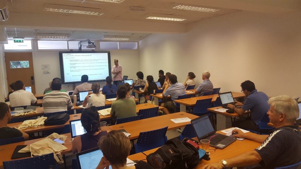
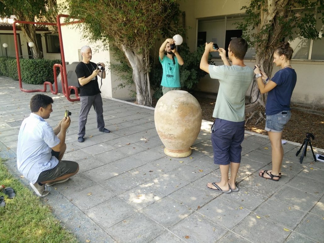
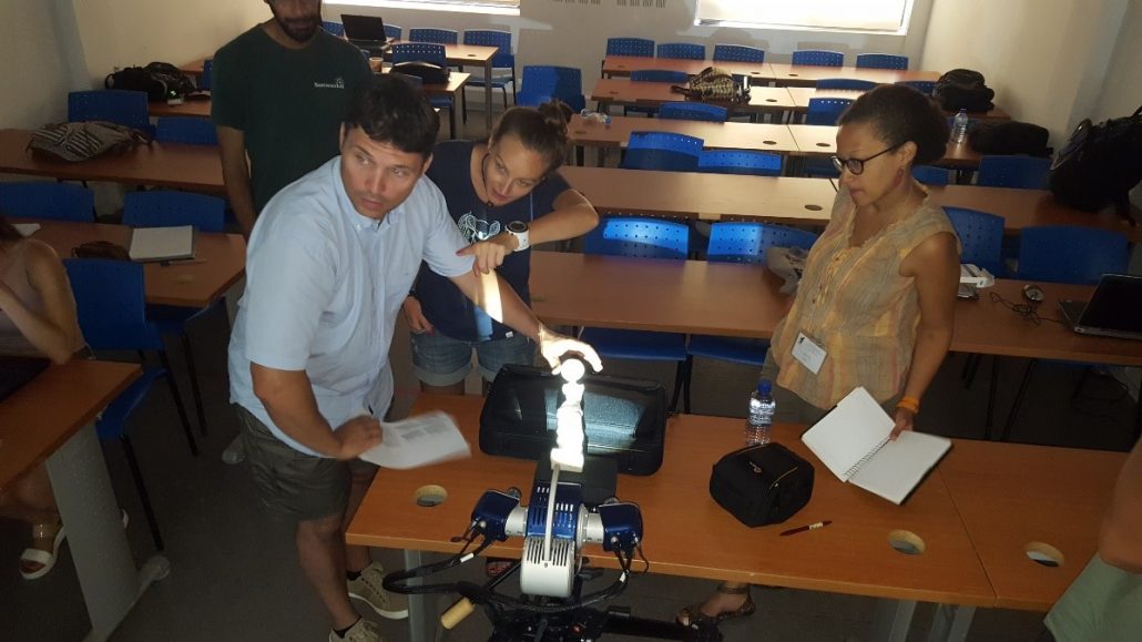
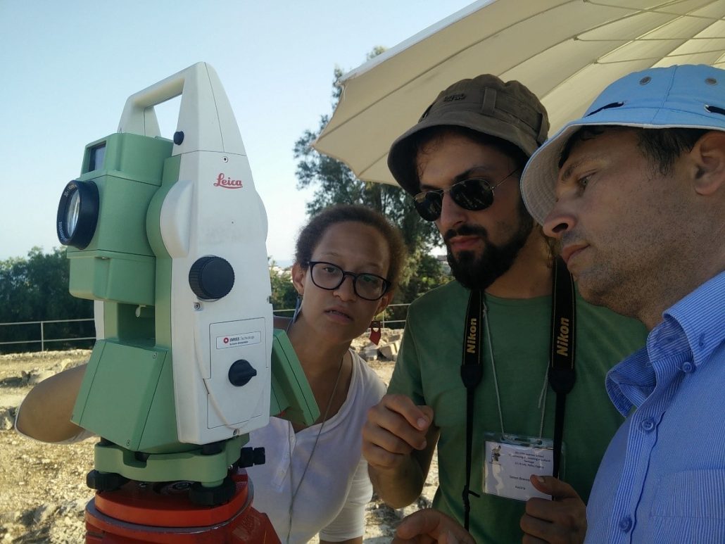
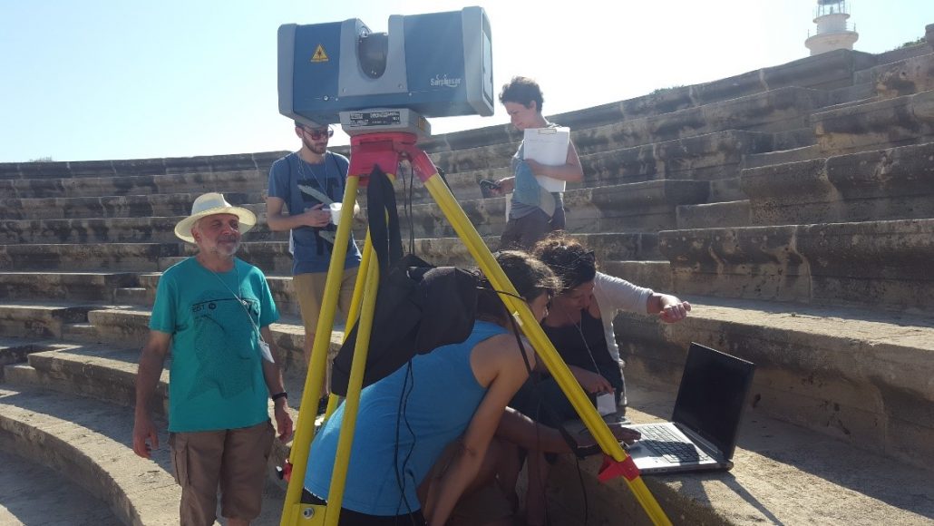
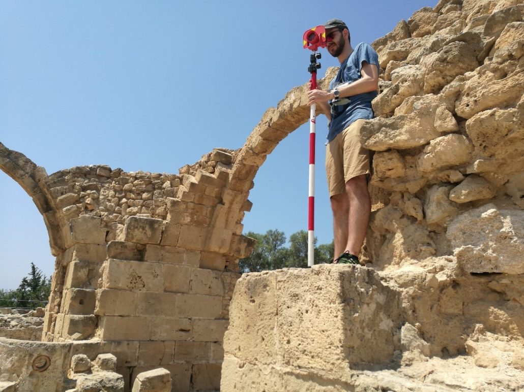
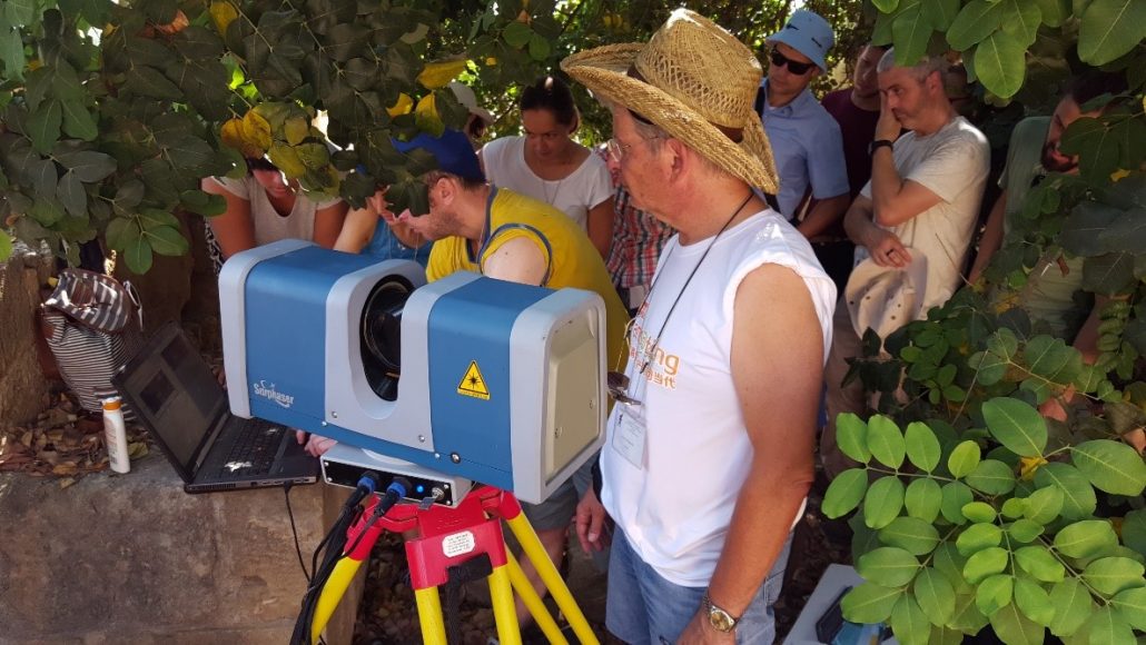
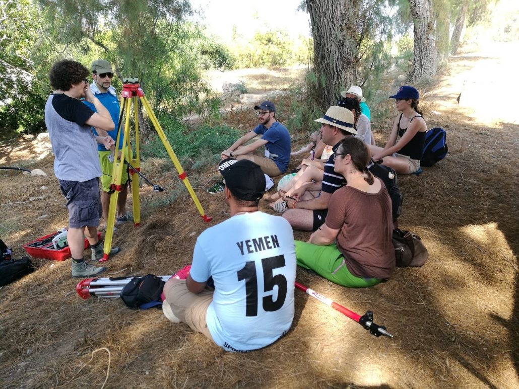
4th CIPA Summer School on “Cultural Heritage 3D Surveying and Modeling”, 12-18 July 2017, Pafos (Cyprus)
The 4th International Summerschool was held in the beautiful location of the Neapolis University in Pafos, Cyprus. The school hosted 19 participants from 12 different nationalities, who were divided into 4 groups for the practical part of the school. The event was supported by all CIPA Sustaining Members and it school gave the opportunity to scholars, PhD students, researchers and specialists in the 3D surveying and heritage fields to refresh and deepen their knowledge and expertise with reality-based 3D modelling techniques. Theoretical lectures in photogrammetry, laser scanning and topography were followed with field acquisitions (with digital cameras, laser scanners, and total stations) inside the Pafos archaeological site as well as data processing in the lab of the University. The participants learned the basics in 3D surveying and data acquisition as well as practice with data processing methods for 3D models and metric products generation. The participants, with the help of some tutors, processed the acquired data and on the last day, they presented the achieved results.
The video of this summer school can also be found on the CIPA YouTube channel.
Anna Nowacka
nowacka.anna.izabela@gmail.com
Arches Version 4 Released
The Getty Conservation Institute is pleased to announce that Version 4 of the open source Arches Heritage Inventory and Management Platform has been released, and includes various configuration tools to ease the process for deploying the software. A demo of Arches v4 will soon be coming to the Arches project website. Development of an Arches online/offline mobile data-collection app has begun and is planned to be released in 2018.
A wide range of heritage organizations internationally already use the Arches platform, with approximately forty known organizations and projects that have deployed or are in the process of implementing Arches. To see a selection of featured implementations of the Arches platform, visit this webpage. Learn more at the Arches website here.
![]()
David Myers
dmyers@getty.edu
www.archesproject.org
Postdoctoral Fellowship in Digital Workflows for Heritage Conservation in Seismic Areas
Application Deadline: Oct 30, 2017
The NSERC CREATE Heritage Engineering program and the SSHRC New Paradigms/New Tools Program are offering a one-year, renewable, post-doctoral fellowship in digital workflows for heritage conservation in seismic areas.
The programs, offered only at Carleton University, provide participants with research, training and international internship opportunities. The Post-Doctoral fellowship also includes an internship component and travel to Myanmar for field work.
Applicants are asked to submit a proposal for research and dissemination of digital workflows for heritage conservation in seismic areas using digitization tools for aerial or terrestrial environments and structural behaviour performance simulation.
Applicants who meet the following criteria will be considered for the post-doctoral fellowship:
- Applicant has successfully completed a Ph.D. degree in Architecture, Civil Engineering or Environmental Engineering within the past five years;
- Applicant has an overall average of A- or higher (GPA of 9.0 on a 12-point scale, or equivalent);
- Applicant has a strong background in and knowledge of heritage conservation;
- Applicant has a good work ethic and strong skills in research, writing, leadership and presentation;
- Applicants should submit a research statement.
The research statement should evidence the candidate’s ability to address the development of standards, guidelines and protocols for the use of digital workflows for heritage conservation in seismic areas, emphasizing the following aspects:
- Digitisation in aerial and terrestrial environments;
- Processing of dense point clouds for heritage conservation needs;
- Use of Building Information Modelling (BIM) and Geographic Information Systems (GIS); and
- Structural behaviour performance simulation.
The research statement should also include a schedule for achieving the project within the one-year time-frame of the fellowship; and should be coherent, persuasive and well-presented.
To apply for the post-doctoral fellowship, an applicant must submit:
- A CV [max. length = 3 pages] outlining:
- academic background;
- professional/work experience;
- research experience; and
- other relevant accomplishments and skills.
- A motivation letter [max. length = 2 pages] setting out the applicant’s:
- background and experience in heritage conservation;
- proficiency and record in academics, research, leadership and presentation; and
- reasons for applying for the one-year fellowship.
- A work sample [URL link or 10MB max. size];
- Graduate and undergraduate academic transcripts [PDF];
- A written research statement [maximum length = 3 pages] that sets out the goals, techniques, components and anticipated outcomes of the proposed research project and outlines a schedule for achieving the project within the one-year time-frame of the fellowship; and a dissemination/valorisation strategy to publish work in scientific journals.
- Two references, consisting of:
- a standard referee’s form; and
- a letter [max. length = 2 pages] addressing: academic ability and record; research ability and record; teaching and language ability; creativity; professional experience; work ethic; and accomplishments, skills and strengths.
General Information about the position and program.
Applications can be submitted online here.
For any questions, please contact Program Coordinator Laurie Smith.
Laurie Smith
Laurie.Smith3@carleton.ca
Agisoft PhotoScan – Professional photogrammetric kit
Agisoft LLC is an innovative research company with focus on professional photogrammetric software development. Agisoft PhotoScan, being run on a single desktop computer (Windows, Linux, Mac OS) or on a cluster for massive data management, enables the user to process digital images into the accurate spatial data, like dense point clouds, textured polygonal models, georeferenced true orthomosaics and DEMs.
Agisoft PhotoScan software presents diverse and advanced functionality making the tool popular among the professionals in various fields. In the IJsselkogge project (The Netherlands, 2015-2016) PhotoScan has been used for the best-preserved medieval shipwreck ever found documentation both underwater and on land, with submillimeter accuracy having been achieved on the ship’s timbers models.
Over 600 historical sites have been documented around South America, including the world-known Machu Picchu city, by Peru’s drone archeology team (founded in 2013), who has chosen PhotoScan software for the imagery processing.
Taiwan’s National Cheng Kung University applied photogrammetry for the project of a different nature – inspection of the damage caused by an earthquake in Taiwan, Feb. 2016.
Furthermore, urban management tasks are effectively solved with 3D models reconstructed for the entire cities, like the one generated for the city of Tomsk, Russia (320 km2, 2014).
Among the recent agricultural user cases, the project held in Central Russia can be named as an example of vegetation index calculation large-scale tasks (1000 ha, 2015).
While all the kinds of applications mentioned above are accuracy-focused, PhotoScan is also employed in the fields where texture quality matters, namely game design and visual effects industries. Popular computer games (Star Wars Battlefront by EA Dice, The Vanishing of Ethan Carter by The Astronauts, The Talos Principle by Croteam) and films (Mad Max: Fury Road by Iloura, Edge of Tomorrow by Sony Pictures Imageworks, Lincoln by Framestore), have proven that PhotoScan photogrammetric software becomes an indispensable part of a designer’s work.
The Agisoft team constantly works on improvements for PhotoScan software to be an efficient solution for the tasks our users face.

Diana Ovod
diana.ovod@agisoft.com
www.agisoft.com
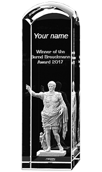
Bernd Breuckmann Award 2017: Call for the submission of proposals for 3D scanning projects in arts and cultural heritage
Win a cash prize of € 1.000, a scanner training and an AICON Scanner on loan for your 3D scanning project
The company AICON 3D Systems is convinced that outstanding ideas are not only worthy of first-class technology, but equally so deserve encouragement and support. This is why we have the pleasure to present the Bernd Breuckmann Award to acknowledge and support the best 3D Scanning Research Idea of a non-profit scanning project in the field of arts and cultural heritage.
Participation is open to all applicants submitting a non-commercial project proposal in the area of arts and cultural heritage, i.e. archaeology, arts, history, paleontology and any related disciplines. In particular young generation scientists are encouraged to participate in this award invitation.
Let us know how an AICON Scanner can help you realize your 3D scanning project in the field of arts and cultural heritage. Closing date for submission is 15 October 2017.
For more information, please visit this site.
Dirk Rieke-Zapp
ac_newsletter@aicon3d.de
aicon3d.com/start.html
RIEGL Announces Significant Product News at Intergeo 2017
RIEGL launches their newest, innovative Waveform-LiDAR sensors and systems at Intergeo 2017 in Berlin.
For terrestrial laser scanning, RIEGL introduced the RIEGL VZ-2000i 3D Laser Scanner. This long-range, very high-speed 3D laser scanner captures up to 1.2 million measurements per second, and covers ranges up to 2,500 m, with 5 mm accuracy and 3 mm precision. RIEGL’s unique Waveform-LiDAR technology enables high speed, long range, high accuracy measurements even in poor visibility and demanding multi-target situations and delivers reliable data even in harsh environments.
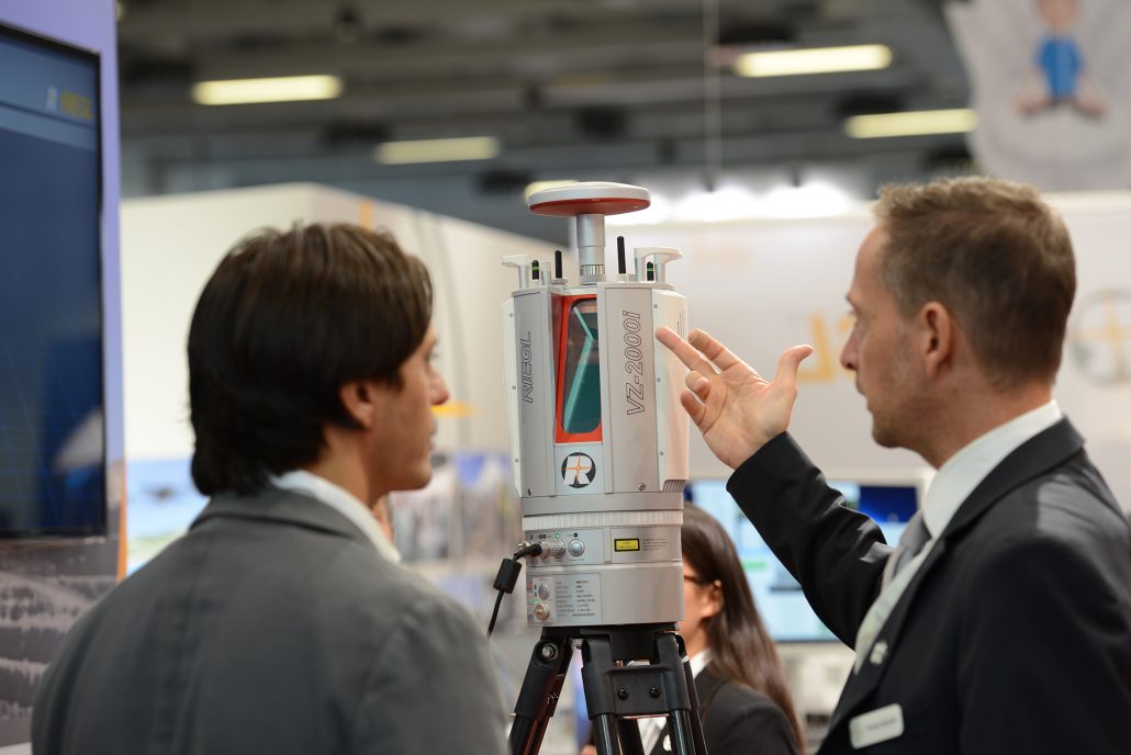
The RIEGL VZ-2000i terrestrial laser scanner
In software related news, also for this addition to the VZ-i Series, RIEGL announced the new and Automatic On-Board Registration as a key feature. Two on-board processors enable the scanner to perform different processes in real-time enabling automatic registration of the scan data already during acquisition in the field. RIEGL also released an app to remotely control their VZ-i series scanners from anywhere in the world. RiPANO software allows for fast and easy visualization of terrestrial laser scan projects where the user can explore 360° panorama views in their browser.
In Airborne Scanning, major news is the RIEGL VQ-780i Waveform Processing Airborne Laser Scanner for ultra-wide area mapping. This advancement of the well-proven RIEGL LMS-Q780 is a high performance, rugged, lightweight, and compact airborne sensor that provides up to 666,000 measurements per second at a 60° scan angle. This versatile system is designed for highly efficient data acquisition at low, mid, and high altitude, covering a variety of different airborne laser scanning applications from high density to ultra-wide area mapping and to provide crisp, clear point clouds by actively suppressing atmospheric clutter.
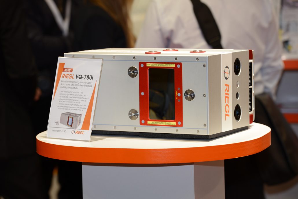
The RIEGL VQ-780i airborne laser scanner
RIEGL also introduced the RIEGL VQ-1560i-DW Dual LiDAR Channel Airborne Mapping System. This new type of the VQ-1560i offers enhanced target characterization by simultaneous measurements with both green and infrared laser wavelengths.
For bathymetric laser scanning, RIEGL introduced the RIEGL VQ-880-GH. This topo-hydrographic airborne laser mapping system now has an optimized form factor with reduced height for helicopter integrations and flexible camera options.
In the UAV segment, RIEGL announced the RIEGL miniVUX-1DL, a “downward-looking” UAV LiDAR sensor. This newest member of the VUX series is perfectly suited for applications such as powerline or pipeline mapping.
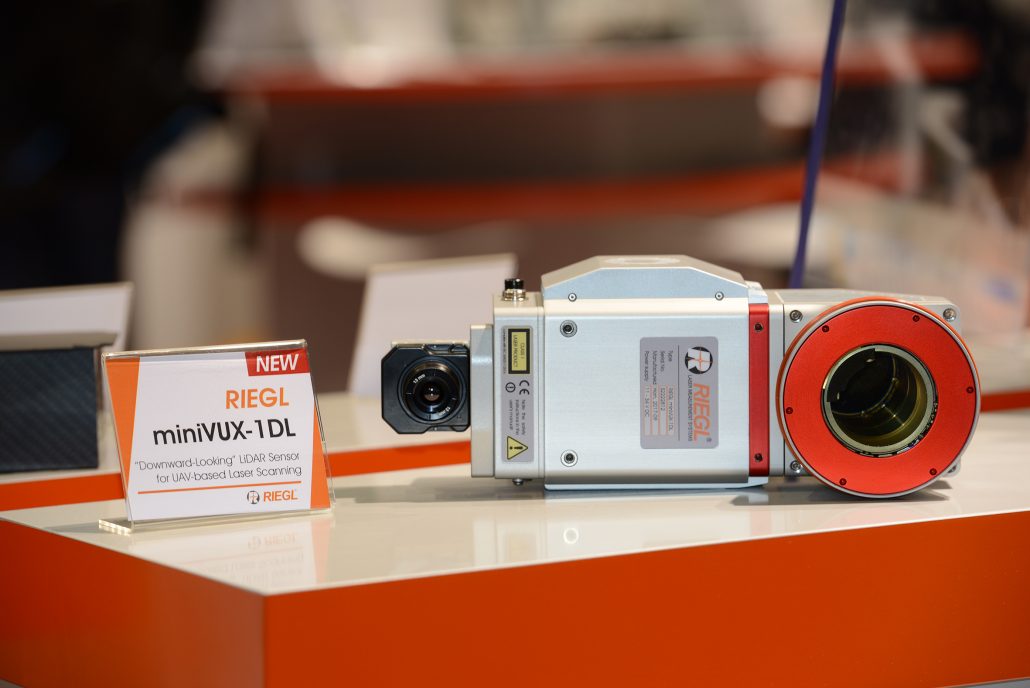
The RIEGL miniVUX-1 DL UAV laser scanner
The RIEGL RiCOPTER-M is a multi-purpose type of the RiCOPTER octocopter for commercial UAV missions. It has an increased 30 kg MTOM (Maximum Take-Off Mass) and a payload capability of up to 10 kg.
The RIEGL VUX-1UAV and miniVUX-1UAV with APX20 are new versions of the popular VUX-1UAV and miniVUX-1UAV LiDAR sensors, integrated with the new APX20 IMU/GNSS system by Applanix.
The RIEGL miniVUX-1UAV Integration Kit has been released for selected multi-rotor UAV types, such as the DJI M600.
Finally, in the mobile segment, the RIEGL VMX-2HA was announced. This high speed, high-performance dual scanner mobile mapping system is an evolution of the proven VMX engineering-grade mobile mapping suite. A new streamlined carbon fiber form factor, flexible camera options, extremely high-speed data transfer and storage are just some of the key features of this latest high-performance mobile mapping system.
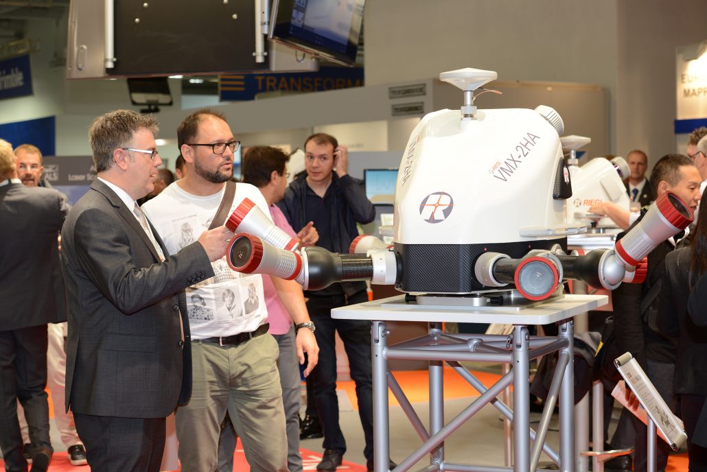
The RIEGL VMX-2HA moble laser scanner
If you are not able to join the RIEGL team at this year’s Intergeo in Berlin to learn about these and many more exciting new products and updates, please visit www.riegl.com or follow RIEGL on their social media channels!
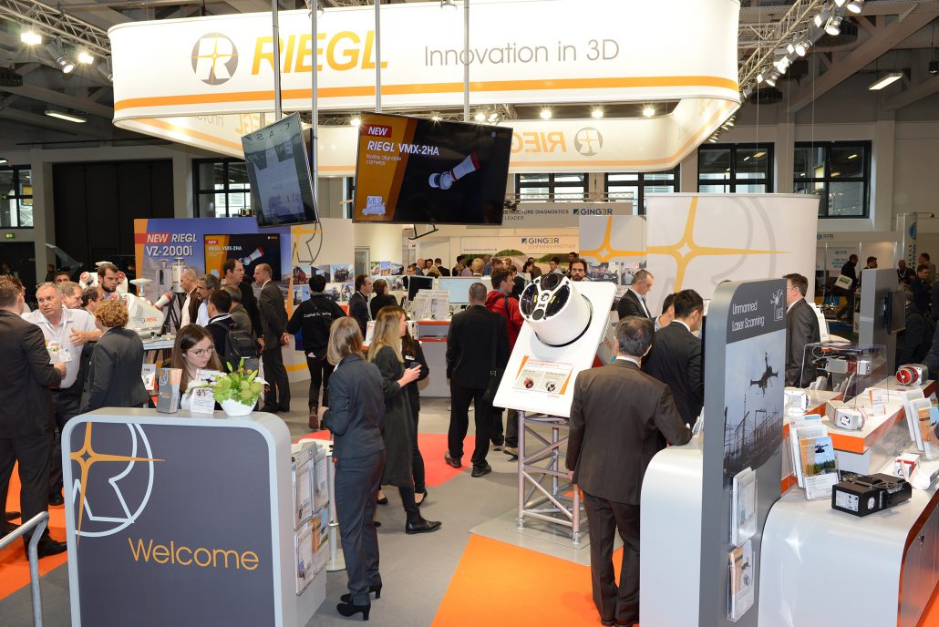
RIEGL at InterGeo
For more information, visit the RIEGL website.
Silvia Zaiser
szaiser@riegl.co.at
www.riegl.com

